
Jump To:
The following street closings are due to scheduled special events such as festivals, road races, walks, and parades, in addition to construction projects. Some of these activities will affect certain traffic patterns across Raleigh over the next several months.
Road Closure Status Alerts
Road Closure Status Alerts
- Code Red Indicates Closed Road
- Code Yellow Roadway status will be an on site decision
- Code Green Indicates Open Road
Please drive slowly and follow the detour route.
Pearl Road Closure Begins Oct. 19
The City's construction contractor will close the Pearl Road-Rock Quarry Road intersection from Oct. 19 through Dec. 17, 2026, to realign it with Barwell Road.
During the closure, drivers will not be able to travel through the intersection of Pearl Road and Rock Quarry Road. A detour will direct traffic to the alternate Pearl Road and Rock Quarry Road intersection near Granite Quarry Drive.
Please follow the posted detour signs and allow extra time to travel through the area. We appreciate your patience as construction continues on Barwell Road.
Projects Affected
Hargett Street Closure Sept. 21-Oct. 9
Plan ahead if traveling on Hargett Street in downtown Raleigh. A full road closure may cause traffic impacts and delays.
Monday, Sept. 21, at 7 a.m., through Friday, Oct. 9, at 5 p.m.
Hargett Street: Between Person Street and S. Bloodworth Street
The road will be closed, with a detour in place to Person Street and S. Bloodworth Street. Local traffic and deliveries will be allowed. Drivers should slow down, follow posted detours and use caution around the work zone.
Projects Affected
S. Bloodworth Street Paving Work
Plan ahead if you're traveling on S. Bloodworth Street. Paving work will reduce the roadway to one alternating lane and may cause traffic impacts and delays.
Monday, Oct. 5, through Friday, Oct. 23, from 7 a.m. to 5 p.m.
S. Bloodworth Street: Between New Bern Avenue and E. South Street
Work will move block by block, starting at New Bern Avenue and progressing toward E. South Street. Street parking will not be allowed during work hours. Drivers should slow down, follow posted traffic advisories and watch for crews in the roadway. Use an alternate route when possible.
Plan ahead if you're traveling on E. Lenoir Street. A full road closure will be in place for construction work and may cause traffic impacts and delays. Detour signs will direct traffic, and local traffic and parking lot access will remain available.
Monday, Oct. 19, through Friday, Nov. 6, from 7 a.m. to 5 p.m.
E. Lenoir Street: Between S. Wilmington Street and S. Blount Street
Drivers should slow down, follow posted detours and use caution around construction crews in the roadway. Remain alert for other travelers and use an alternate route when possible.
Projects Affected
Intersection Closure: S. Blount and E. Lenoir Streets
Plan ahead if you're traveling through the intersection of S. Blount Street and E. Lenoir Street. The intersection will be closed for a Capital Improvement Project, and a detour will be in place. Motorists should expect possible traffic impacts and delays.
Monday, Oct. 26, through Friday, Nov. 6, from 7 a.m. to 5 p.m.
S. Blount Street and E. Lenoir Street: Intersection closure
Crews will work along S. Blount Street and E. Lenoir Street throughout the project. Drivers should slow down, follow posted detour signs and watch for crews in the roadway. Use an alternate route when possible.
Projects Affected
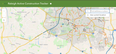
Raleigh Active Construction Tracker
This new map shows construction projects happening around Raleigh in public spaces. It includes City and State projects as well as any private work that is permitted in the public right-of-way, such as utility installation. Projects are colored by owner. City projects are orange, state projects are blue, and private work is in gray.
You can quickly zoom to your neighborhood or area of interest using the search bar in the upper right. Click any project to learn more and find a link to full project details when available.
Raleigh Construction Tracker GIS Map