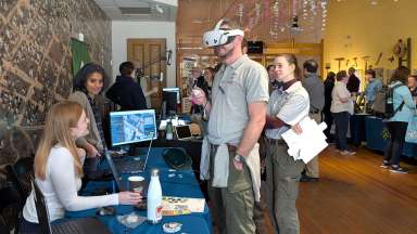
Thanks to all who joined the City of Raleigh’s Information Technology Department for an exciting morning of exploration, innovation and discovery at GIS Day 2025 at the City of Raleigh Museum. Geographic Information Systems (GIS) help us better understand the world around us. This tool helps us understand and visualize information based on location. It is like a smart map that can do more than just show you where things are. It can also tell you what’s happening there, how things are connected and help people make better decisions.
2025 Professional and Student Map Contest Winners
Map entries had to be an original work that used GIS-based data or tools. They were displayed during the GIS Day event. Winners were chosen by popular vote.
Professional Map Contest winner is Tia Francis, who works in the City's Planning and Development department, with the map highlighting "City of Raleigh Annexation History."

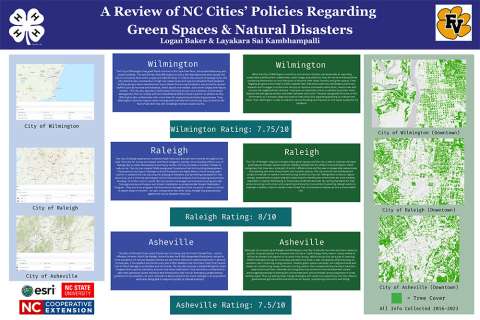
Student Map Contest winner is Layakara Sai Kambhampalli with "A Review of NC Cities' Policies Regarding Green Spaces & Natural Disasters."
Thanks to our Partner Participants During the Event
Center for Geospatial Analytics at NC State
Center for Geographic Information & Analysis (CGIA)
City of Raleigh Parks and Recreation
City of Raleigh Planning and Development
City of Raleigh Information Technology
City of Raleigh Transportation
City of Raleigh Transit
City of Raleigh Water
City of Raleigh Solid Waste Services
City of Raleigh Stormwater
Town of Garner
NC Department of Health and Human Services
NCDOT Rail Division
North Carolina Department of Environmental Quality
WCPSS UAS Teams
Wake County Public School System
Wake County 4-H Youth Development
Wake County Board of Elections
Wake County Planning Department
Wake County Portfolio & Project Management Team
Wake County Property Mapping