Jump To:
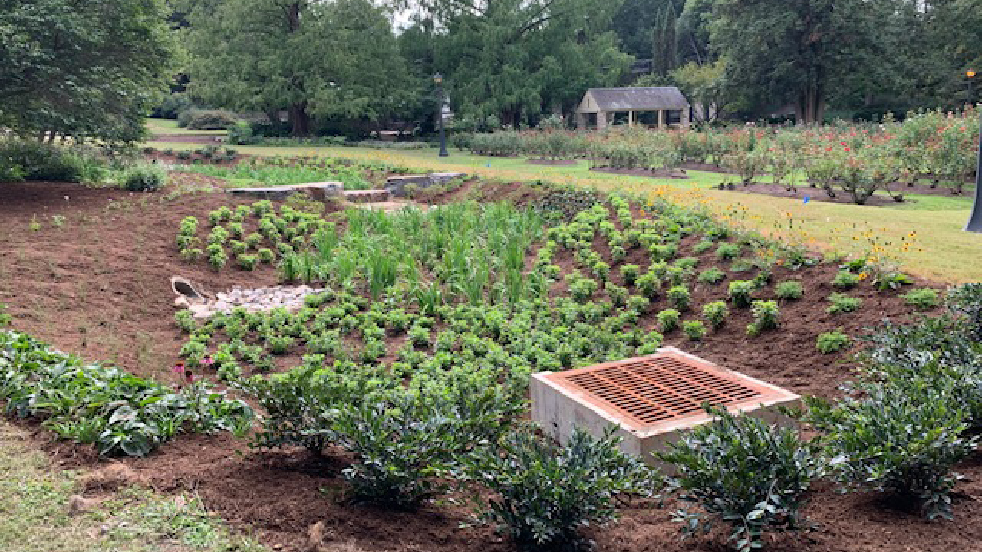
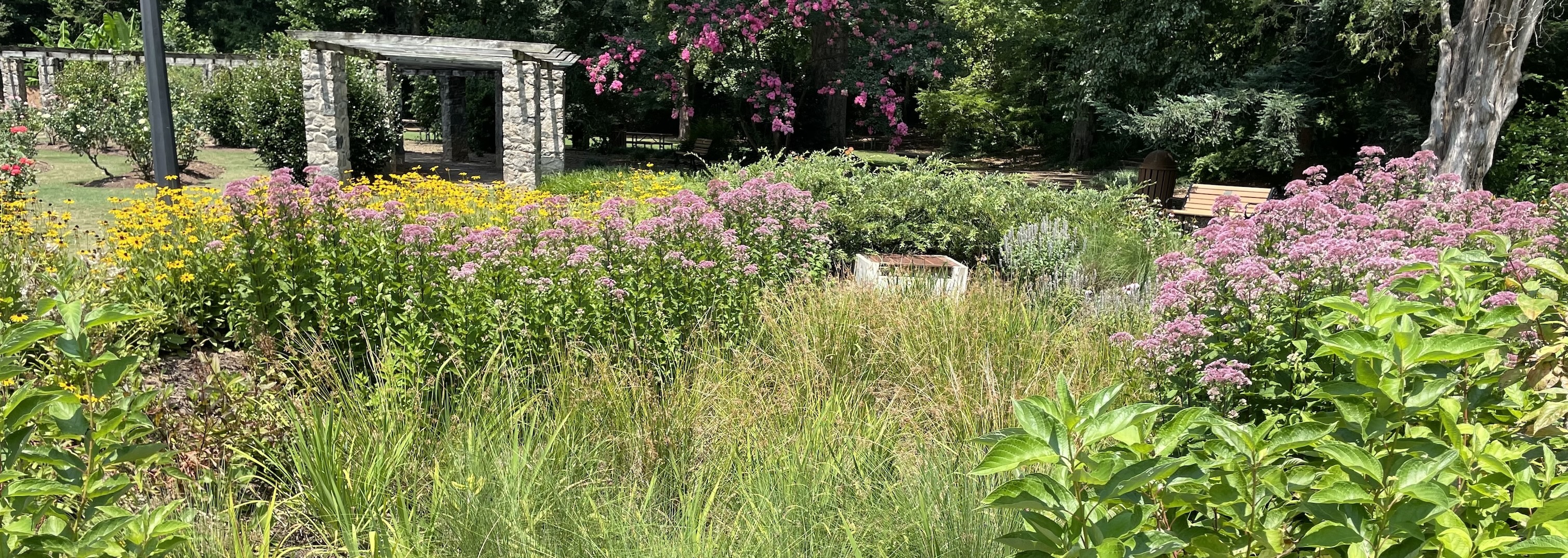
A planted bioretention area at Raleigh Rose Garden that helps protect Beaverdam Creek from water pollution.
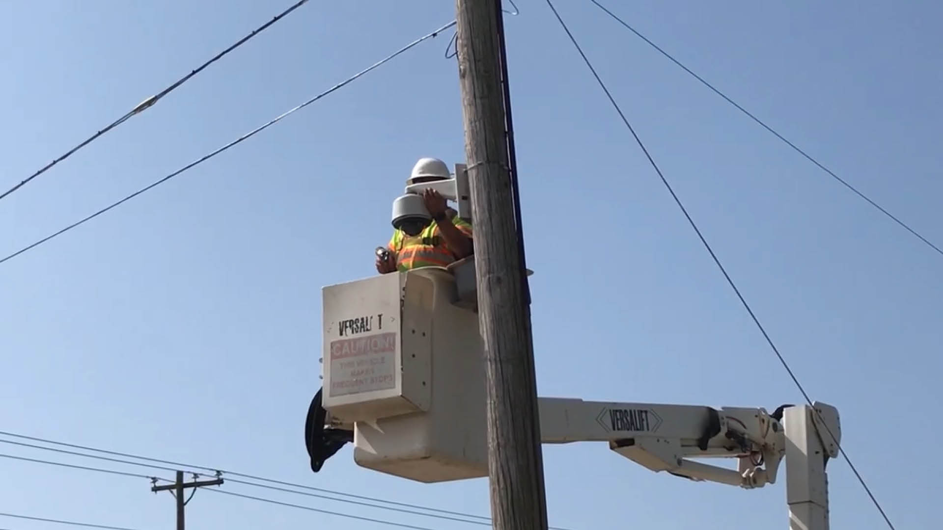
A camera used to track road flooding in Raleigh. The camera helps us see when an area is flooding so we can put proper safety measures in place.

Creek flooding over a greenway bridge on Rose Lane.
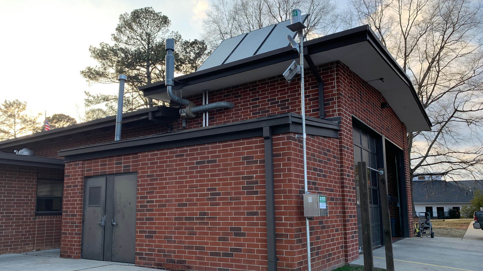
A view of the USGS rain gauge installed at Fire Station 15 in Raleigh. The gauge will tell us how much rain is falling in this area.
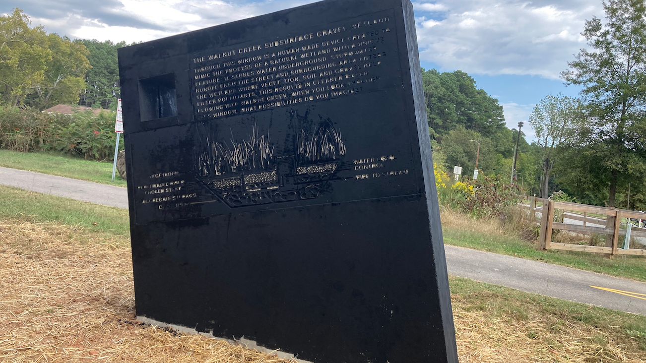
Healing Continuum
The Healing Continuum sculpture serves as educational art that informs and engages the community about the Walnut Creek Gravel Wetland. The gravel wetland slows down and captures runoff coming from Peterson Street and other nearby streets, sidewalks, and buildings, and removes pollutants before it enters Watson Branch, which then drains into Walnut Creek. In addition to its water quality benefits, the gravel wetland is planted with native plants to provide habitat and food sources for birds, butterflies, and other wildlife.
On the side of the sculpture facing the creek, visitors will find a diagram of the wetland and its components, a built-in window for viewing the wetland, and a description of how it functions.
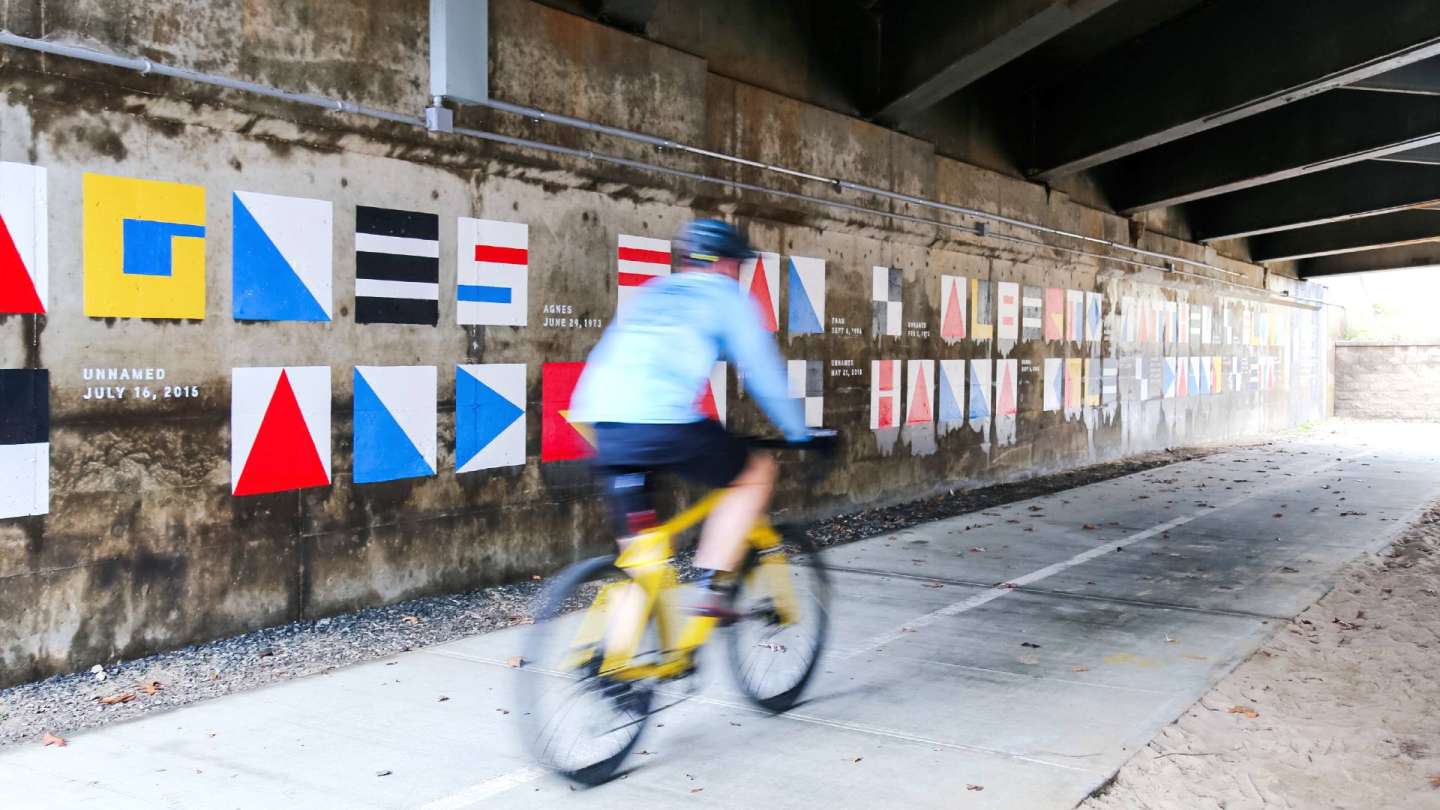
Alluvial Decoder
Alluvial Decoder is a site-specific education installation about the floodplain at Crabtree Creek near the greenway trail on Glenwood Avenue and Crabtree Valley Avenue. A mural under the bridge displays the name of storms that have caused flooding in Raleigh. The names are Agnes, Fran, Eta, Hanna, Alberto, Kyle, Matthew, Danny, and Floyd. A series of markers represent several historic floodwater heights. A key under the bridge reveals the names and dates of the storms represented. Learn more about the floodplain creative education installation.