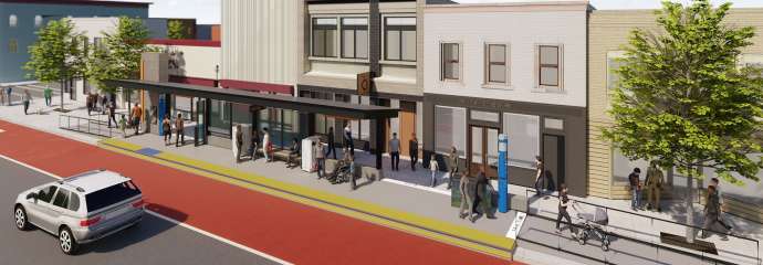
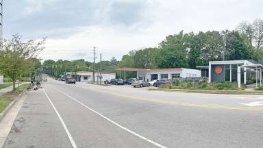
This shows what the urban core BRT transit station will look like, the rending here show the one on Wilmington Street.

Planning

Western and Southern Transit Overlay District (TOD) Mapping

Applying the new TOD zoning district to the Western and Southern BRT corridors

The TOD Mapping applied the TOD zoning district to some areas along the Western and Southern Bus Rapid Transit routes.

At the July 5, 2022, public hearing, the City Council approved the request to apply the TOD along the Southern BRT route (Z-19-22). At the August 16, 2022, public hearing, the City Council approved the request to apply the TOD along the Western route (Z-18-22).

Project Details

 
Type:
Zoning
Date Range:
-
Lead Department:
Planning and Development
Service Unit:
Planning

Subscribe


Background

As part of planning for Bus Rapid Transit (BRT), the City-initiated a project to plan for development around BRT routes. This project is called Equitable Development Around Transit (EDAT). In 2021, the City Council adopted the recommendations of the project. These include creating new zoning rules for areas next to BRT routes that encourage the type of development that will support the BRT system, including allowing more people to live and work in walkable places served by transit. The TOD zoning was designed to meet those goals. It ensures areas near transit are pedestrian-friendly and have active uses that support transit and create lively places. It also encourages the provision of affordable housing units.

The TOD zoning was updated to support BRT by text change TC-17A-20. The text change was adopted by the City Council on October 5, 2021. This made the updated TOD overlay zoning district part of the City’s development code. For more information about what is included in TOD visit What is a Transit Overlay District?

For more information about what is included in TOD visit What is a Transit Overlay District or watch the video below:

Transit Oriented Development (TOD)

Project Intent

The Western and Southern TOD mapping project is one way that the City has implemented the recommendations of the EDAT project. The project applied the TOD to properties along the Western BRT corridor that follows Western Boulevard and the Southern BRT corridor that follows S. Wilmington Street. You can see where the TOD is applied by using the iMAPS tool. Turn on the “Overlays” layer to see the TOD. View the Western and Southern TOD Mapping Criteria page for more information about how the area was determined.

Planning and design of the BRT routes and station areas may result in the application of the TOD in other areas in the future.

Schedule

This project started with a set of introductory meetings in the fall of 2021 and then followed the rezoning process.


Timeline

Introductory community meetings

November 16 and 30, 2021
View Recording

First neighborhood meeting

January 19 and 20, 2022 at 6 p.m.
View Recording - Jan. 19
View Recording - Jan. 20

Rezoning application submitted by City

February 15, 2022

Second neighborhood meeting

March 23 and 29, 2022
View Recording - Mar. 23
View Recording - Mar. 29

Planning Commission review

April 21, 2022
May 26, 2022, (meeting canceled)
June 23, 2022, at 4 p.m.

City Council review

Public Hearing
July 5, 2022, at 7 p.m.

View Recording
August 16, 2022, at 1 p.m. (Z-18-22)
View Recording

The first community meetings were held in November 2021. Two public meetings were held in January 2022. Links to presentations and video recordings from the January meetings are listed below.

Western Corridor Neighborhood Meeting (Downtown Raleigh to Cary) - January 19, 2022
Presentation | Video

Southern Corridor Neighborhood Meeting (Downtown Raleigh to Garner) - January 20, 2022
Presentation | Video