Short-Term Implementation
At the regular Council meeting on Nov. 4, the City Council approved a staff-recommended short-term implementation strategy that includes:
- Modifying horizontal planters to gain space for activation and outdoor seating.
- Introducing public art designed to create engaging visual experiences within the corridor.
- Fabricating and installing wayfinding and interactive seating elements.
- Adding new outdoor seating and activation elements.
For more information and project updates, visit the Fayetteville Street Streetscape Improvements Project page.
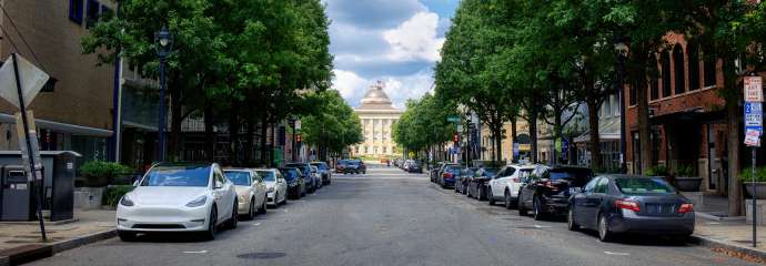
Fayetteville Street Streetscape Plan
The City of Raleigh is developing an updated Streetscape Plan for Fayetteville Street, located in the core of its downtown. The project will develop a regulatory document to set design standards for landscaping, lighting, public art, site furnishings, and pedestrian improvements. The plan will also provide a preliminary utility redesign and an implementation plan for future phases of capital improvements along the street.
The project was identified as a prioritized action item in the Downtown Raleigh Economic Development Strategy – A Five Year Plan full report (August 2024), released by the Downtown Raleigh Alliance (DRA), which focused on reactivation strategies for Fayetteville Street. The goal of the project is to provide a streetscape plan that furthers commercial activation while respecting and enhancing the unique historical context of the corridor.
Project Details
- Type:
-
Corridor Studies
- Date Range:
- -
- Budget:
-
$500,000
- Project Lead:
-
Dylan Bruchhaus
- Contractors:
-
McAdams