Flooding in Raleigh

Severe Weather Preparedness

Promoting Safety During Storms in Raleigh


Jump To:

 
Severe Weather Preparedness Week Types of Severe Weather Severe Weather Alerts Preparing for Severe Weather

Severe Weather can occur at any time of the year, but the most common time of the year is during the spring and fall seasons. This is typically when Central North Carolina can experience the worst periods of severe weather. Residents and visitors in Raleigh should make efforts to ensure to be prepared for severe weather. Severe Weather information can help residents take action to protect life and property.

There is a Statewide Tornado Drill scheduled for Wednesday, March 6 at 9:30 a.m.

Severe Weather Preparedness Week

Severe Weather Preparedness Week is March 3-9 and will highlight a specific severe weather topic each day. Visit the links below to learn more details about each topic and how to prepare for them.

DateTopic
Sunday, March 3Overview of the week
Monday, March 4Severe thunderstorms and tornadoes
Tuesday, March 5Ways to receive severe weather alerts, and information about the Statewide Tornado Drill
Wednesday, March 6Staying safe when high winds, hail, and tornadoes strike
Thursday, March 7Lightning safety
Friday, March 8Flash flood safety
Saturday, March 9Make a plan and encourage others to do the same

Types of Severe Weather

Click through the images to learn more about the different types of severe weather. This information is provided by the National Weather Service.

Thunderstorms

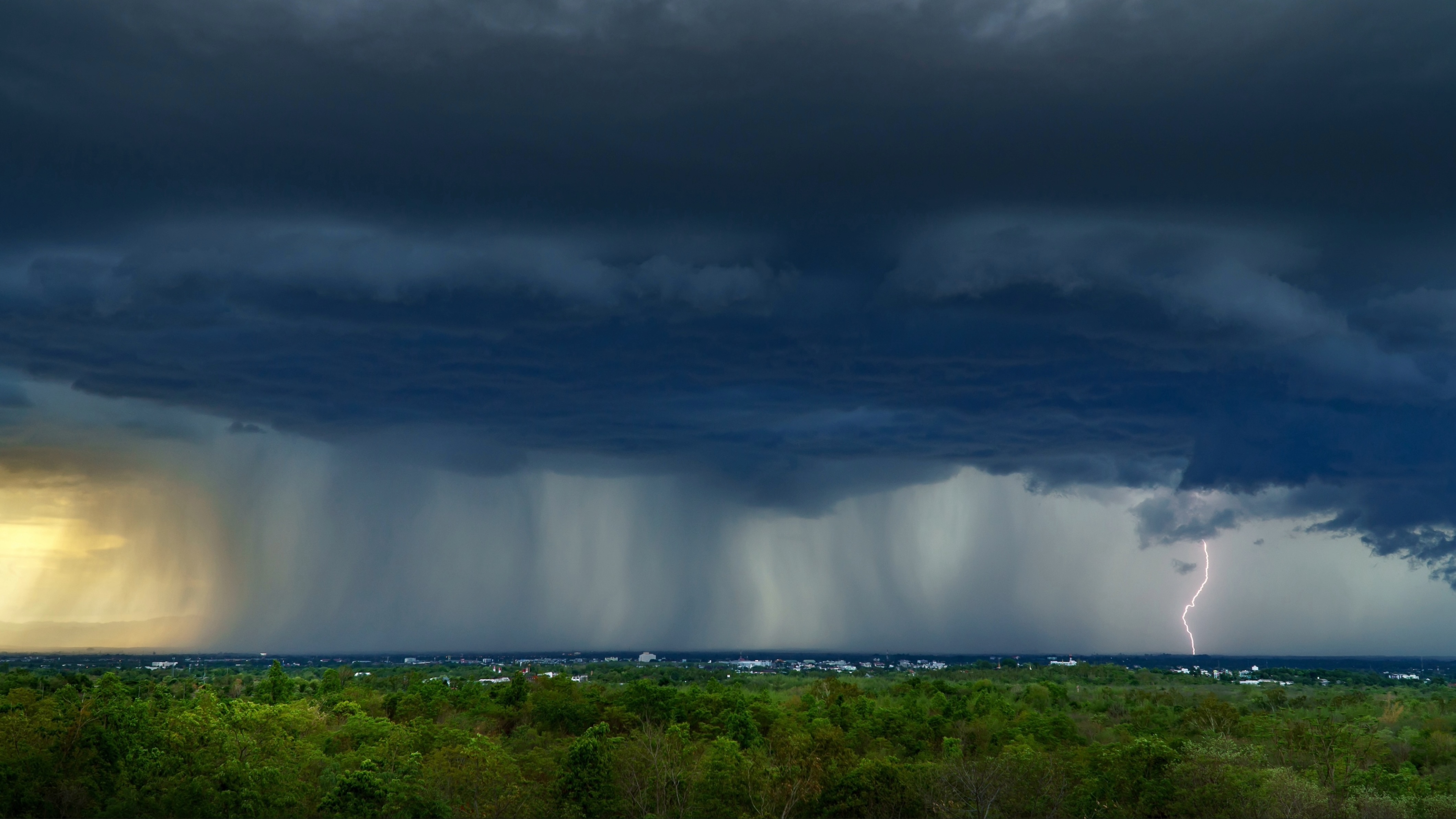
A thunderstorm is a local storm that produces lightning and thunder.  Thunderstorms are often accompanied by showery rain and gusty winds, and may also bring hail or snow. Thunderstorms occur most frequently during the spring and summer, but they are also possible in the fall and winter.  North Carolina experiences about 40 to 50 thunderstorm days per year.  About 10 percent of thunderstorms are classified as severe – one that produces hail at least an inch in diameter, has winds of 58 miles per hour or stronger, or produces a tornado.
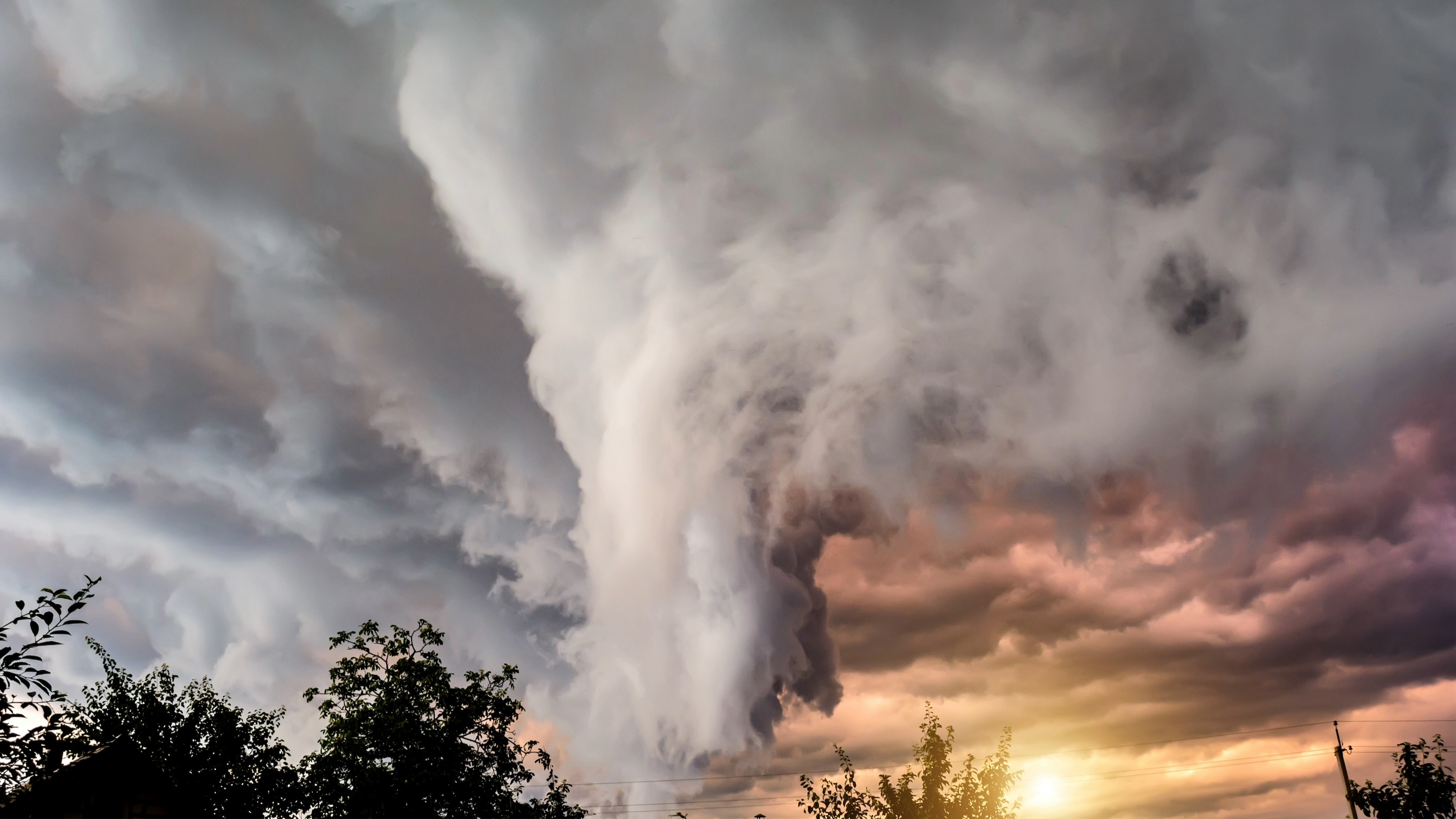
Tornadoes

Tornadoes are natures most violent storms. Spawned from powerful thunderstorms, tornadoes can cause fatalities and devastate a neighborhood in seconds. A tornado appears as a rotating, funnel-shaped cloud that extends from a thunderstorm to the ground with whirling winds that can reach 300 miles per hour. Damage paths can be in excess of one mile wide and 50 miles long.  Some tornadoes are clearly visible, while rain or nearby low-hanging clouds obscure others. Sometimes, tornadoes develop so rapidly that little, if any, advance warning is possible.
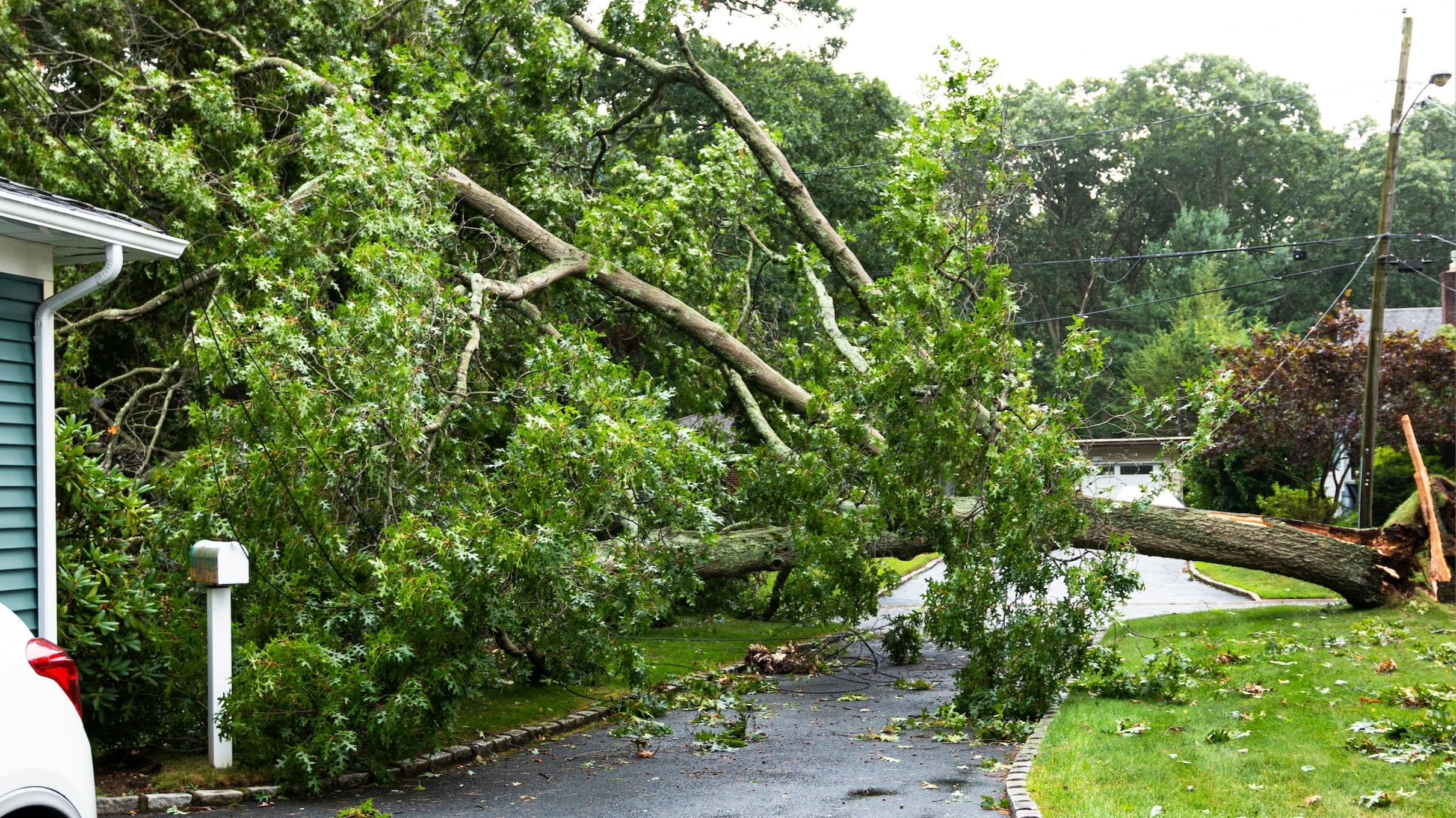
Wind

Straight-line winds can topple trees onto cars, houses, and power lines. Many deaths from straight-line winds are the result of trees falling onto the person, whether they are outside, in their house, or driving in their car. Strong straight-line wind events can even destroy buildings, especially mobile homes and manufactured homes.

Hail

Hail is a form of precipitation consisting of solid ice that forms inside thunderstorm updrafts. Hail can damage aircrafts, homes, and cars, and can be deadly to livestock and people. Hail can exceed the size of softballs and fall at speeds of over 100 mph, seriously injuring or killing anyone in its path.
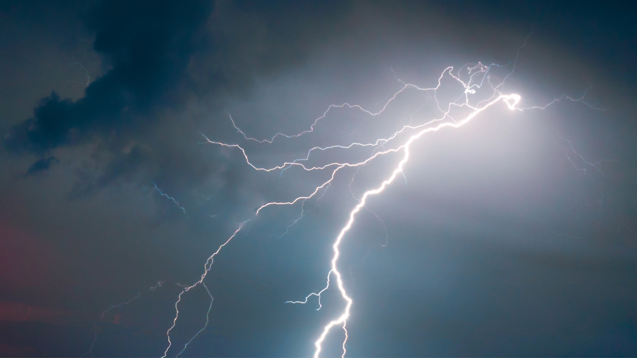
Lightning

All thunderstorms produce lightning and are dangerous.  Lightning often strikes outside the area of heavy rain and may strike as far as 10 miles from any rainfall. The most effective lightning safety action can be found in avoiding the lightning threat altogether. If thunderstorms are in the forecast, consider postponing activities to avoid being caught in a dangerous situation.
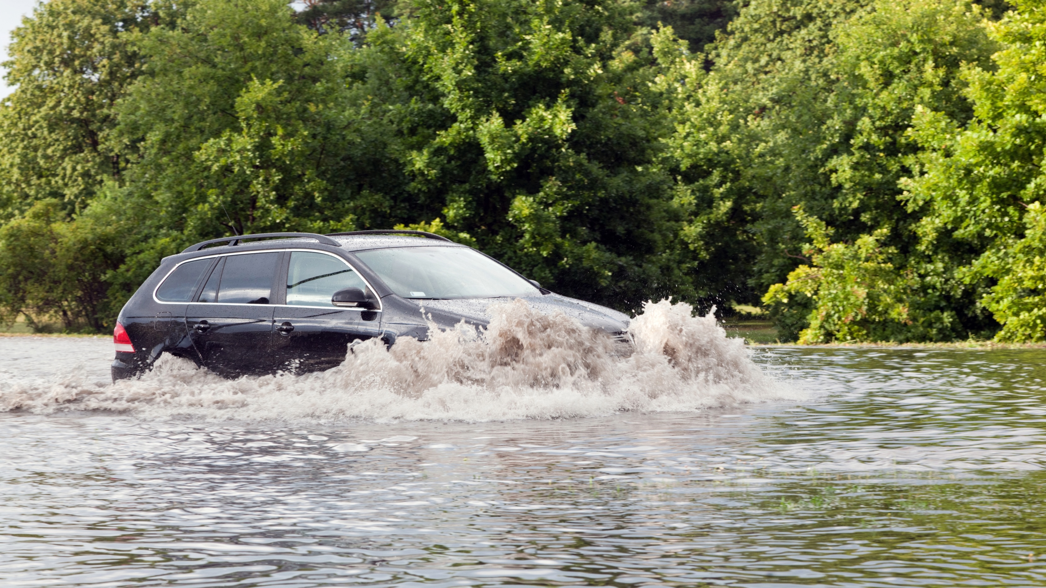
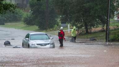
Flooding

Flash flooding in North Carolina usually occurs when a large amount of rain falls in an area over a short period of time. The ground can only soak up so much water in a given time, and when the rain rate exceeds what can infiltrate into the ground or run off into drainage systems or streams, flooding is likely to occur. Hurricanes, tropical storms, and ordinary thunderstorms can produce flash flooding.

Severe Weather Alerts

The easiest way to receive severe weather alerts is to set up Wireless Emergency Alerts (WEA) on your smartphone. These alerts do not require an app. When the location of your phone is issued a Flash Flood Warning or a Tornado Warning, the alert will be sent directly to your phone like a text message.

Other ways to receive weather alerts include:

Preparing for Severe Weather

The best way to stay safe during severe weather is by making a Severe Weather Safety Plan with friends and family to know where to go and what to do during emergencies.

Tornado Safety

When a Tornado Warning is issued, residents should seek safe shelter immediately. The vast majority of injuries and deaths occur from flying debris. Move to the lowest floor of your home or business, and into an interior room, closest, bathroom, or hallway without winds. Use pillows, mattresses, and even bicycle or motorcycle helmets to protect yourself from flying debris. If in a mobile home or car, take shelter in the nearest business or a ditch if that’s possible.

Flood Safety

Pay attention to road closures during flash flooding. Barriers and detours are put in place for safety. Most importantly, emergencies should be reported to 911. Stay updated on flooded streets and roads in Raleigh by Tracking Storms with Us and following Raleigh Water on Twitter and Facebook for urgent storm alerts.

Tracking Flooding in Raleigh

Get an inside look at how our flood monitoring system works – We use gauges to track stream levels, cameras to monitor road flooding, and signs to notify resident when water reaches the road.

Contact


Kelly Daniel
Flood Early Warning System Manager
jonathan.daniel@raleighnc.gov
919-996-4020

Ethan Clark
Flood Early Warning System Intern
ethan.clark@raleighnc.gov
919-996-4020

Department:
Engineering Services
Service Categories:
Stormwater
Related Services:
Track Storms with UsEmergency Preparedness - Ready Raleigh Guide

Subscribe