Station Area Planning New Bern Header

Planning

Station Area Planning: New Bern

Creating transit-friendly neighborhoods for all.

View the New Bern Station Area Planning proposed rezoning changes.

To ask questions about the rezoning, contact Ira Mabel at 919-996-2652. You can also provide comments directly to City Council.

Next Steps

City Council approved the Comprehensive Plan amendment CP-7-22 on January 30, 2024.

On March 5, 2024, City Council closed the public hearing and took the following actions on rezoning request Z-92-22:

  • Applied the Transit Overlay District (TOD) as recommended by Planning Commission's Committee of the Whole, except for:
    1. Properties within an existing NCOD.
    2. State-owned property.
    3. Properties with a submitted public request for removal from the rezoning.
  • Rezoned 600 New Bern Avenue and 17 S. Swain Street from NX-3 GR w/NCOD and NX-3 w/NCOD to NX-5 w/TOD.
  • Rezoned Zak’s Gas 76:
    1. 1069 New Bern Avenue from CX-3-UL to CX-5.
    2. 1611, 1617 & 1619 New Bern Avenue from NX-3-UL to NX-5.
    3. 1701, 1705, 1707, 1711 & 1721 Boyer Street; 103, 105, 107 & 111 Waldrop Street from R-10 and RX-3 to RX-5.
  • Rezoned Duplex Village (1902, 1928, 1932 & 1936 New Bern Avenue; 118, 120 & 122 Russ Street; 1921 & 1925 Hawkins Street) from R-10 to RX-5 and RX-5-GP.

City Council will continue discussing Z-92-22 on Tuesday, April 2, 2024, beginning at 1 p.m. in the Council Chamber, 222 W. Hargett Street.

Planning Commission Recommendations

Planning Commission has recommended approval with revisions (7 - 0) of Comprehensive Plan amendment CP-7-22 and denial (4 - 3) of rezoning request Z-92-22. Read their full recommendations for CP-7-22 and Z-92-22.

Planning Commission's Committee of the Whole has made the following recommendations:

  • Rezoning request Z-92-22 should be approved with the modifications recommended by the Committee:
    1. All Raleigh Historic Landmarks should be removed from the rezoning
    2. Proposed maximum building heights between East Street and Raleigh Boulevard should follow the map labeled "Alternative C."
    3. Wherever the Transit Overlay District (TOD) is mapped, any existing Neighborhood Conservation Overlay District (NCOD) should be removed.
  • City Council should authorize a text change to review how neighborhood transition standards are applied within the TOD.

Recommendations for each of the 49 public requests received are:

Location

Request

Committee Recommendation

E1: 4000 New Bern Avenue

Remove from rezoning

Denial

E2: Thelma Street

Add to rezoning

Approval

E3: 3601 Bastion Lane

Add to rezoning

Approval

E4: Essie & Polly Streets

Add to rezoning

Approval

E5B: 3705 New Bern Avenue

Modify rezoning

Approval

M1: Calumet Drive & Holston Lane

Modify rezoning

Denial

M2: Calumet Drive & New Bern Ave

Modify rezoning

Denial

M3: 101 N. Peartree Lane

Add to rezoning

None

M4: New Bern Ave, between Longview Lake Drive and Donald Ross Drive

Remove from rezoning

Denial

M5: 2324 New Bern Avenue

Remove from rezoning

Approval

M6: 122 Clarendon Crescent

Add to rezoning

None

M7: 2120 New Bern Avenue

Remove from rezoning

Denial

M8: 104 Lord Ashley Road

Remove from rezoning

Approval

M9: 109 Lord Ashely Road

Remove from rezoning

Approval

M10: 1919 New Bern Avenue

Remove from rezoning

Approval

M11: 2010 Poole Road

Remove from rezoning

Approval

M12: 2405 Poole Road

Add to rezoning

Denial

M13: 2231 New Bern Avenue

Maintain rezoning

Approval

M14: 2435 New Bern Ave

Remove from rezoning

Approval

W1: 1601 & 1604 Miller Street

Add to rezoning

Denial

W2: Lenoir Street & Bart Street

Add to rezoning

Denial

W3: 19 & 23 Bart Street

Add to rezoning

None

W4: 1246 & 1250 New Bern Avenue

Modify rezoning

Denial

W5: 300 St. Augustine Avenue & 1502 E. Lane Street

Add to rezoning

Denial

W6: 1100 New Bern Avenue

Modify rezoning

Denial

W7: 827 Cotton Place

Modify rezoning

Approval

W8: 814 & 818 Cotton Place

Add to rezoning

Denial

W9: 912 E. Hargett Street

Add to rezoning

None

W10: 911 E. Martin Street

Add to rezoning

Denial

W11: 717 E. Martin Street

Add to rezoning

Denial

W12: 1100 block of Boyer Street

Remove from rezoning

Denial

W13: 121 N. Tarboro Street

Remove from rezoning

N/A

W14: 111 N. State Street

Add to rezoning

Denial

W15: 117 Idlewild Avenue

Remove from rezoning

Denial

W16: 115 Idlewild Avenue

Remove from rezoning

Denial

W17: 118 Seawell Avenue

Add to rezoning

None

W18: Kirkman Lane & E. Hargett Street

Add to rezoning

None

W19: 542 E. Edenton Street 

Remove from rezoning

None

W20: 540 E. Edenton Street

Remove from rezoning

Denial

W21: 541 E. Edenton Street

Remove from rezoning

Denial

W22: 537 E. Edenton Street

Remove from rezoning

Approval

W23: 525 & 533 E. Edenton Street

Remove from rezoning

Approval

W24: N. East Street, between New Bern Avenue and Edenton Street

Modify rezoning

Approval

W25: Morson Street

Add to rezoning

Denial

W26: 325 E. Edenton Street

Add to rezoning

None

W27: Boyer Street and Waldrop Street

Modify rezoning

None

W28: 203 S. Tarboro Street

Add to rezoning

None

W29: 600 New Bern Avenue & 17 S. Swain Street

Maintain rezoning

N/A

W30: 574 New Bern Avenue

Maintain rezoning

N/A

O1: All properties within NCODs

Remove from rezoning

Denial

For more detail of each request see the Z-92-22 Public Engagement Summary .

Plan Recommendations

The plan proposes big ideas and details of how to:

  • Address affordability
  • Expand housing choices near bus rapid transit stations
  • Make walking safer and easier
  • Assist existing small businesses and future entrepreneurs
  • Tell the story of New Bern’s history and culture boldly in the form of public art and placemaking.

Want a closer look?

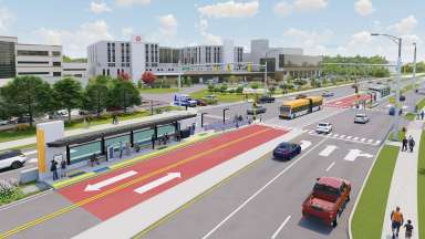
Transit is a means of connecting people with opportunity. It also is a tool for improving sustainability and equity. In a growing city like Raleigh, transit helps people get around in a way that is affordable, supports walkability, and that reduces carbon emissions.

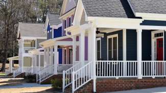
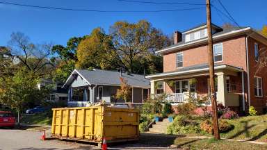
Making the most of a transit investment means thinking about how to grow around transit. The goal of this New Bern Station Area Planning project is to support healthy, affordable, and equitable neighborhoods around the city’s planned bus rapid transit (BRT) system. These neighborhoods will offer a range of places to live and work. Streets will be safe and comfortable for people walking and taking the bus.

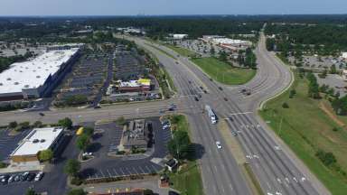
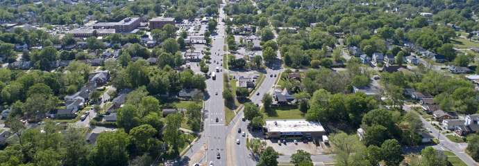
This process is separate from the design of the New Bern BRT stations and bus lanes. It is a community planning process that will consider areas within a short walk of the BRT stations along New Bern Avenue.

Follow us on Instagram for videos and other updates!

Looking for a quick introduction to the project? Check out the video or view the materials from the different phases of the study below.

Project Details

 
Type:
Corridor Studies
Date Range:
-
Project Lead:
Ira Mabel, Senior Planner

Contact


Email: Ira Mabel, Senior Planner
919-996-2652

Lead Department:
Planning and Development
Service Unit:
Planning

Subscribe


Strategy

Date Range:
-

Area plans are an important part of how the city adapts to change and addresses key issues, such as housing affordability, walkability, and reducing carbon emissions. To learn more about area planning in general visit the info page.

They offer a chance to dive deeply into issues and concerns in specific parts of the city. In this case, the focus is on neighborhoods along New Bern Avenue. In addition to thinking about making the most of the BRT investment, this process also recognizes that concerns already existed about housing affordability and displacement in those neighborhoods. This plan is a way to address those issues.

Equitable Development Around Transit

We’ve started to think about those issues broadly as part of the Equitable Development Around Transit plan. That process looked at all four BRT corridors and looked to answer two big questions: 

1) To what extent should Raleigh grow more around transit, as opposed to driving, in the future?  

2) How do we ensure the benefits of BRT are shared equitably? 

We heard clearly that Raleigh should work toward becoming a much more sustainable and transit-oriented city, and that affordable housing is absolutely critical.  

We’ve published the Equitable Transit-Oriented Development Guidebook, which outlines a path toward meeting those goals.

It includes strategies and tools for allowing more people to live and work in areas near BRT, to improve housing affordability and choice, and to make it easier and safer to go places by walking or biking.

This process will tailor those strategies to the New Bern Avenue corridor.

What are the main tasks involved in the plan?

We started this process by hearing from you on the most important issues to tackle. We heard that walkability and pedestrian safety are critical, and that thinking about places to live, work, and shop near BRT – and working to address affordability – are key topics.

This process, which separate from the design of the New Bern BRT itself, will involve the following major elements:

  1. Study the current conditions of the area. This includes research on housing costs, identifying areas that are challenging to pedestrians, and neighborhoods that have easy access to jobs and shopping.
  2. Understand how area residents, businesses, and institutions would like for their neighborhoods to make the best use of BRT and address other issues.
  3. Develop Strategies to help residents of all income levels afford to live in the area, make it safer to walk, and look to identify other goals.
  4. Create a Plan for each station area that includes zoning changes, new programs, and funding sources to make the plan a reality.
Lead Department:
Planning and Development

Planning

Date Range:
-

Community Connection and Understanding the Area

This phase involved working with the community to talk about the goals of the project and set up the best ways to communicate. It also involved gathering data about housing, transportation safety, and other key topics. It led to the main phase of the study, which will involve developing plans for each station area.

See the results and key reports from this phase:

The Story of New Bern Avenue document and video.

Maps that illustrate data and key issues.

A summary of input from this first phase.

Affordable Housing Summit

View the presentation and videos of the resident-focused and housing provider sessions from our Affordable Housing Summit held in September.

Community Workshops

This process recently included three week-long workshops, one for each portion of the New Bern corridor. See the links below for initial concepts and presentations!

Project Engagement Summary

Read a full summary of the public engagement for the entire project.

Lead Department:
Planning and Development

What areas are we studying?

row of single story homes in east college park with porches

The study will focus on areas within walking distance of proposed BRT stations along New Bern Avenue. Those neighborhoods include Oakwood, Olde East Raleigh, College Park, Battery Heights, Longview, King Charles, and Beacon Lake.

It also includes commercial, institutional, and mixed-use areas such as WakeMed hospital, shopping centers outside the Beltline, and areas such as the former DMV building.