Project Status
The 30% schematic design was approved by City Council during their Jan. 7, 2025 meeting. Please visit the Engagement Portal to learn about the public engagement process for this project.
Project Overview
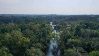
The Walnut Creek Trail is an existing trail within the Capital Area Greenway System that runs from Lake Johnson on the west to the Neuse River Trail on the east, primarily along Walnut Creek. Constructed between 1988 and 2002, portions of the Walnut Creek Trail are some of the oldest in the Capital Area Greenway System. Time and exposure to the harsh conditions experienced within floodplains are showing its effects on the Walnut Creek Trail with worn and cracked pavement.
Additionally, changing desires for using the Capital Area Greenway System has resulted in more users accessing the trails to reach destinations in addition to use for recreation. This has increased the need to reduce impacts from flooding events by designing and building trails that are further removed from the possibility of flooding and providing alternative routes when flooding does occur. For all these reasons, sections of the Walnut Creek Trail are in need of improvement to meet the needs of users today.
The Walnut Creek Trail Improvement Project includes the section of the Walnut Creek Trial between Lake Wheeler Rd on the west and Sunnybrook Rd on the east, as well as the section of the Rocky Branch Trail between Lake Wheeler Rd on the northeast and the intersection of the Rocky Branch Trail with the Walnut Creek Trail on the southeast. The project includes four sections of trail, each of which will require its own specific improvements.
- Section 1 includes the Rocky Branch Trail between Lake Wheeler Rd and the Rocky Branch Trail/Walnut Creek Trail intersection. This portion of the project includes repaving, grading, and connection improvements to where the Rocky Branch Trail intersects with the Walnut Creek Trail.
- Section 2 includes the Walnut Creek Trail between Lake Wheeler Rd and S. Wilmington St. This portion of the project includes bicycle/pedestrian bridge replacement evaluation, repaving, grading, evaluations to connections to the planned Downtown South Development and the potential re-alignment of the Walnut Creek Trail to better connect to the Rocky Branch Trail at S Wilmington St.
- Section 3 includes the Walnut Creek Trail between S. Wilmington St and Rock Quarry Rd. This portion of the project includes potential realignment to reduce flooding impacts, potential bicycle/pedestrian structure replacement, repaving, grading, and trail connectivity improvements to surrounding neighborhoods.
- Section 4 includes the Walnut Creek Trail between Rock Quarry Rd and Worthdale Park. This portion of the project includes potential repaving of existing trail, improving connections to surrounding neighborhoods, improvements to reduce impacts due to flooding between Dacian Road and Rose Lane, the potential relocation of the section of trail between Rose Lane and Sunnybrook Road to run along Walnut Creek instead of along Little John Road and an evaluation of potential improvements to the surrounding transportation network to provide safe detour routes in the event the Walnut Creek Trail is inaccessible due to flooding.
Project Schedule: 2024-2028
Interactive map of Park Projects
2022 Parks Bond Spending Tracker
List of Park Projects
Project Details
- Type:
-
Greenways and Trails
- Budget:
-
$10,015,000
- Contractors:
-
Design Consultant - McAdams


