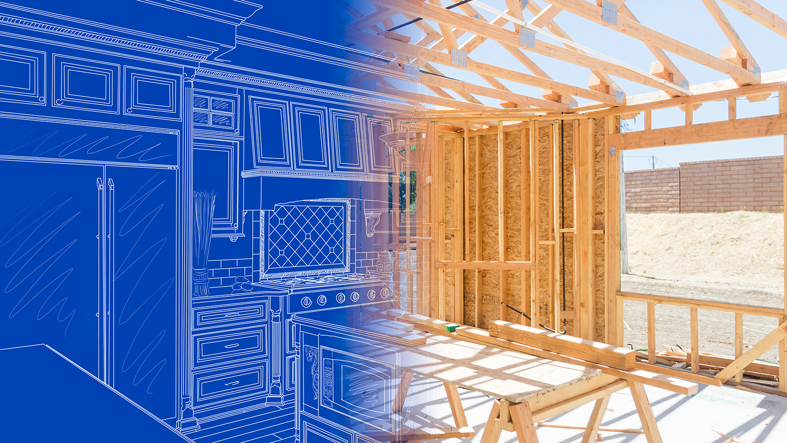
Building a city involves eight main stages from concept to completion. The City of Raleigh uses an eight-stage development process to guide how land is planned, built on, and inspected. The first three stages are legislative, which means the City Council must vote on them. The last five stages are administrative, which means City staff must make sure they follow the law. Learn more about the development process and view the City’s performance metrics below.
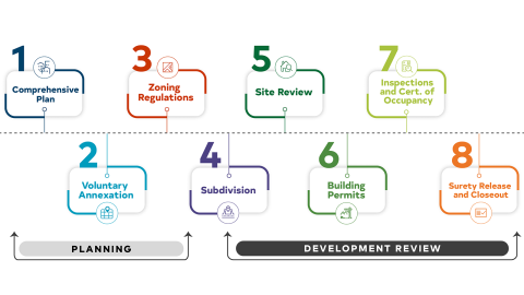
The Comprehensive Plan is Raleigh’s long-term policy roadmap that looks ahead 20 years into the future. It helps determine how the city grows, where people live, where new infrastructure is built, and how everyone gets around. The current Comprehensive Plan covers 2009 to 2030, and the City is currently working on a new version, Reflecting Raleigh, to prepare for the next 20 years. The Comprehensive Plan can be amended for a variety of reasons.
Voluntary Annexations happen when a property owner asks to officially become part of the City of Raleigh. If the city agrees, the property receives "essential services" such as police and fire protection, city water, and trash pickup, and the owner begins paying City property taxes. Because annexations are voluntary, the City doesn’t control when they happen, and they make up a smaller part of our growth than in past years.
Zoning rules help organize land in the city and control how it’s used. It divides land into different "zones” for different uses, like homes or businesses. To find out how a property can be used or what can be built, start by checking its zoning. If someone wants to change how their land is used, they have to go through a rezoning process. While Raleigh is growing in population, 2% or less of the city is rezoned every year.
A Subdivision is when one large piece of land is split into smaller lots. New lots are required to have the right infrastructure - like water lines and streets - before any structures are built. Once approved, a detailed map called a plat is recorded with Wake County to show exactly where each property line sits. Subdivision allows for the sale and development of individual lots for all kinds of development.
After the land is properly divided, the next stage in the development process is called Site Review split into Administrative Site Review and Site Permit Review. This will allow for the development of projects, like apartment buildings or shopping centers. Experts make sure the project follows all local safety rules before permits are approved and any construction starts.
Before someone can actually start building or remodeling, they need a Building Permit. This is an official document that proves the project is legal and safe. It makes sure that the plans meet the "building code" - a set of state standards for how buildings must be constructed.
Once construction begins, city experts visit the site in person to complete inspections. Both Residential inspectors and Non-Residential inspectors check everything in the project plan, from the foundation and roof to the wires and pipes. Non-Residential inspectors visit many types of construction job sites, such as commercial, institutional, and industrial. All inspectors make sure the work matches the approved plans and is safe for people.
When a project starts, the developer provides a Surety, which acts like an insurance policy or deposit. At the end of the project, the city does a final check called a closeout. If everything was built correctly and all required fees have been paid, the city returns the developer’s surety. This makes sure taxpayers aren't stuck paying for any unfinished work, such as landscaping, street construction, or stormwater control.