Lower Longview Streambank

Stormwater

Lower Longview Streambank Stabilization

Stormwater Drainage System Improvements

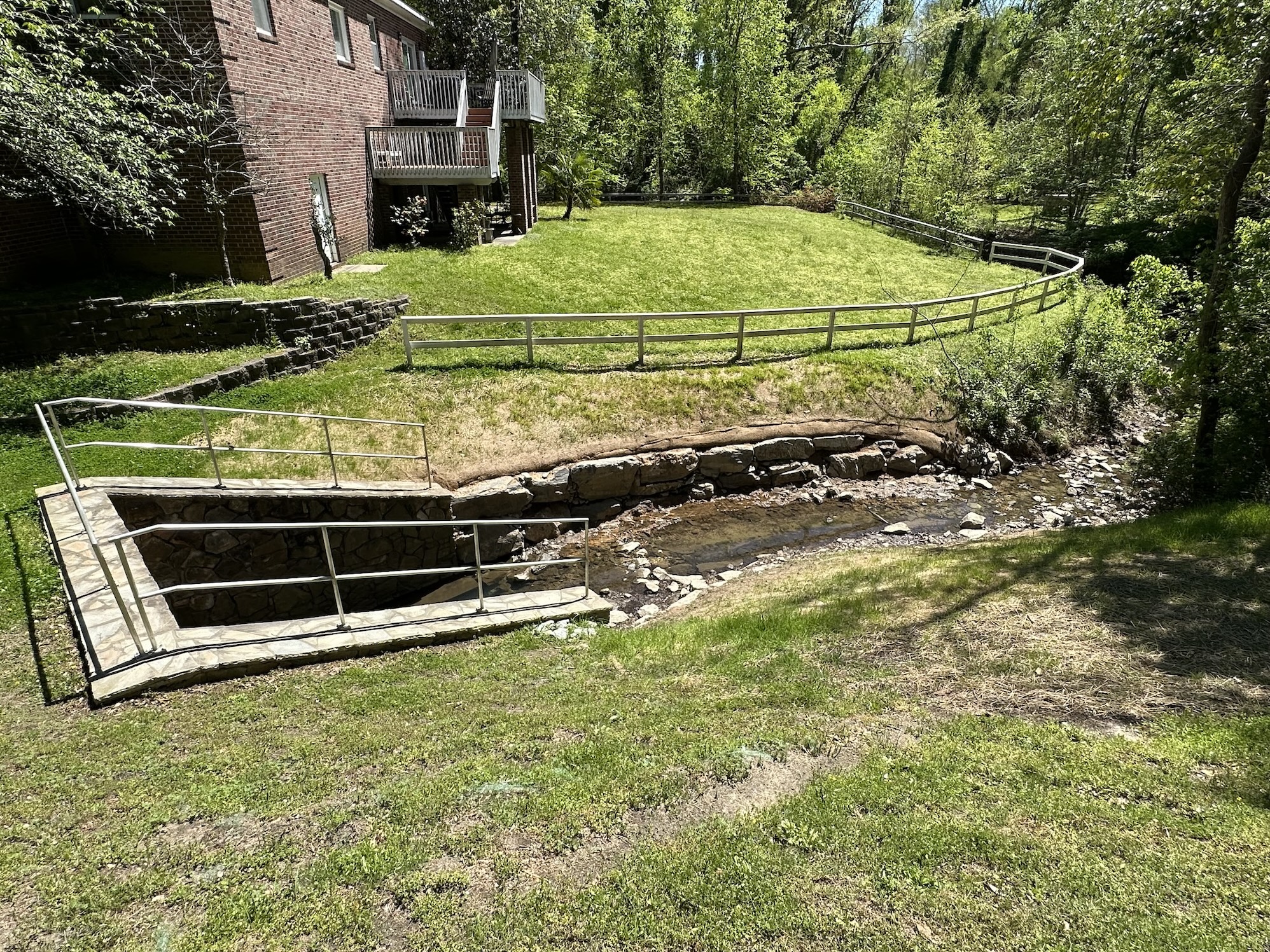
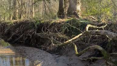
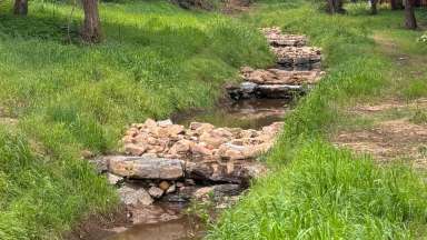
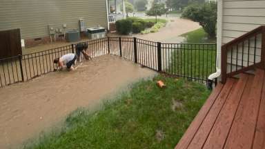
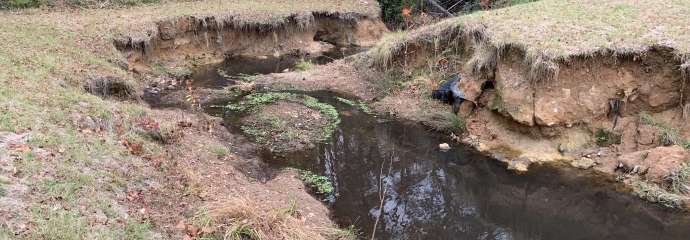
We will repair the eroded streambanks downstream of the Lower Longview Dam. There are two locations of streambank erosion to be fixed:

  1. The stream channel immediately downstream of the dam outlet structure.
  2. The stream channel immediately downstream of the culvert under Milburnie Road.

The project will include boulder wall structures at both project locations to address the existing erosion.

Project Details

 
Type:
Stormwater
Budget:
$97,939 (Design)
Project Lead:
Stormwater Management
Contractors:
Ecosystem Planning and Restoration, PLLC (EPR) (Design)

Contact


Kyle Bucher
Senior Engineer
kyle.bucher@raleighnc.gov
919-996-4068

Lead Department:
Engineering Services
Service Unit:
Stormwater

Subscribe


Planning

This phase is complete.

Lead Department:
Engineering Services

Design

Design plans were submitted January 2024. Permitting and easement acquisition phase to follow in Late Spring 2024.

Project Goals

Install boulder wall structures to minimize erosion during large rain events at project locations.

Boulder Wall Example

Boulder Wall Example

Lead Department:
Engineering Services

Construction

Construction will be in Summer 2024.

Lead Department:
Emergency Communications

Schedule

DateActivity
Fall 2023Surveys and Field Data Collection complete
Fall 2023Design Phase begins
Early Spring 2024Permitting and Easement Acquisition
Late Spring 2024Design Phase complete

Project Map

Zoom in on the map below to see where we're working on this project. Select the three lines on the map (upper right corner) to see what the icons mean.

Background

The Lower Longview dam project had a coffer dam fail in 2018, resulting in a deluge impacting the downstream channel. There are two locations (see location map) that were severely impacted by this and continue to erode during large rain events. First, the channel immediately downstream of the dam outfall has severely eroded banks for approximately 100 feet downstream, down into the forested area to the confluence with the natural channel.

The second location is downstream of the culvert under Milburnie Rd. On the left bank, there is an existing cinder block retaining wall that has been undermined on the backside from the coffer dam failure and high rainfall events. The remedial design will consist of stream stabilization measures, likely including bank armoring and grade control structures, at the upstream location. The downstream location will likely involve use of backfill and permanent liner to fix the erosion behind the existing wall.