Jump To:
A recorded map, also known as a plat, is an important component of land development in North Carolina. They are official maps that delineate the boundaries of a piece of land, typically divided into lots or parcels, which are then used for residential, commercial, or industrial purposes. Plats are created through a process that involves surveying, mapping, and regulatory approval by local governments. They provide a legal and visual representation of the division of land and are crucial for establishing property rights, land use planning, and infrastructure development. In North Carolina, plats are subject to state laws and regulations, as well as local ordinances, to ensure proper land development and adherence to zoning requirements. Understanding the role and requirements of plats is essential for developers, landowners, and local officials involved in land development and real estate transactions in North Carolina.
The Recorded Maps Review Process ensures that plats are recorded in the Wake County or Durham County Register of Deeds Office:
- The plat meets state and local regulations.
- Accurately reflect approvals associated with preliminary subdivision plans, administrative site reviews, or master plans that may precede them.
- Establishes boundaries and addresses that affect the construction of buildings on the property.
Maps for recording within the Raleigh ETJ must be submitted to and approved by Planning and Development prior to submission to the Wake County Register of Deeds, except for certain boundary surveys.
Before Submitting an Application
- For any recording, a legally licensed North Carolina professional land surveyor must stamp and seal the maps. Land surveyors act as consultants for clients by preparing maps and performing data research for map reviews.
- Approval of a subdivision or site plan where public infrastructure is to be constructed must be approved prior to the submittal of the recorded map.
- Some recorded maps require Site Permit Review (SPR) approval prior to the submittal of a recorded map.
- Maps related to developments for which a preliminary plan has been approved (site plans, subdivisions, or master plans) where conditions of approval note “Prior to lot recordation” must satisfy all of these conditions prior to submittal mylars, including the preparation and review of all legal documents that may be associated with these conditions.
- All previous property recordings must be provided on maps, including the Book of Maps and deed references (including book and page references).
Prepare Application Materials
The below application forms and supporting documents are required for recorded maps:
- Recorded Map Application Packet
- Legal Documents: All legal instruments required by the city in association with a development approval must be reviewed and approved, and then the executed copies must be received by staff prior to the approval of the recorded map.
Locked templates for easement documents can be found on the Development Forms webpage. Legal documents are submitted for review to the following email address: legaldocumentreview@raleighnc.gov.
There is a 10-business day turnaround for legal document review submissions using an official locked COR template. Any submittals using an altered form will be considered unlocked, and there will be no guaranteed turnaround time. - Recombination Deeds: If the map is submitted as a recombination and there are two or more owners of the parcels that are being recombined, copies of the proposed deeds delineating the new, recombined parcels is required.
Submittal Instructions
Please send the recorded map along with the Recorded Map Application Packet via email to sitereview@raleighnc.gov. Each document must be submitted as a separate PDF file with a corresponding filename. For assistance, please contact the Planning and Development Customer Service Center at 919-996-2500.
Common Types of Plats
Subdivision: the division of a tract or parcel of land into two or more lots. An approved preliminary subdivision plan is required prior to the submittal of a recorded map.
Recombination: the combination or recombination of previously recorded lots.
Boundary Survey/Easement Dedication: surveys of existing tracts legally created through previously recorded documents or maps. These maps may be recorded without prior authorization by the city, but no easements, notations, or other matters of record may be altered, added to , or removed from a previously recorded property without city authorization.
Exempt Subdivision: new tracts of land where all tracts, including any residual parcel, are ten (10) acres or larger and no right-of-way dedication is involved.
Right-of-way/Permanent Slope Easement: the dedication of public roadways and exclusive slope easements in conformance with the Street Plan Map and the Table of Right-of-Way requirements.
Tree Conservation Area: a map with metes and bounds descriptions of all tree conservation areas.
Project Review and Permitting
- The applicant submits the recorded map packet via email to sitereview@raleighnc.gov. A licensed North Carolina professional land surveyor must prepare, stamp, and seal a map for recording. Consult a surveyor well in advance of the need to record the map. For maps that require approval of legal documents related to an approved preliminary subdivision, the legal documents are required to be submitted with the recorded map.
- The Planning and Development Customer Service Center routes your recorded map package to staff members who have expertise in planning, transportation, stormwater, public utilities, urban forestry, addressing, and greenways. The team reviews the recorded map in conformance with the Unified Development Ordinance, as well as the policies, procedures, and regulations in the Public Utilities Handbook, Street Design Manual, and Stormwater Manual.
- Corrections and recommendations for your project can be reviewed in the Permit and Development Portal. Applicants, as well as any other project contacts, must be registered in the portal to view this activity.
- Applicants are expected to address each staff correction in writing and submit a revised plan for review.
- Once all corrections have been resolved, the surveyor can submit mylars for review. The following items must be provided (NOTE: If all four of these items are not submitted at the same time, the submittal cannot be processed):
- Mylar(s) - signed and sealed by all parties.
- A written response to all outstanding comments.
- One digital copy of the signed mylars and the written responses (in PDF format) on a flash drive (required since not all reviewers view physical copies).
- A form of payment at the time of submission (check or debit/credit card).
- Once your plan review is complete plans can be picked up at the Customer Service Center. Schedule your appointment for pick up on the Development Appointments webpage.
- Once mylars are signed by the review officer, the applicant receives approval to record the plat in addition to any required legal documents at the Wake County Register of Deeds Office. The plat must be recorded on or before the 14th day following the certification of the review officer. The expiration date shall be clearly indicated on the plat. The associated legal documents are required to be recorded within 1 business day of the plat recordation.
- If the client does not record the plat within the 14 days, the mylar(s) of the plat must be re-submitted to the coordinating review officer, who will review them to ensure that no changes have been made and re-authorize the recording, starting another 14-day window to record.
Paying Fees
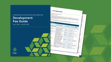
The Development Fee Guide provides a detailed list of specific development fees.
- It is recommended that fees be paid via the Permit Portal.
- All major credit cards and eCheck payments are accepted.
- If you have questions, please contact the Customer Service Center.
A fee calculator may be used to obtain an estimate of some building and trade permit fees.
Revisions to an Approved and Signed Plat (Not Yet Recorded)
If your plat has been approved and signed by the Review Officer but has not yet been recorded, you may request revisions before it is officially recorded.
To initiate this process, the applicant must submit a written request to Planning and Development describing the proposed changes. Your request must:
- Clearly identify the proposed revisions; and
- Include a brief explanation or reason for each change.
Planning and Development staff will review your request to determine whether the revisions:
- Remain consistent with the approved preliminary plan; and
- Do not result in major changes to the plat.
If your revision request is approved, you will be asked to submit:
- A revised recorded map showing the approved changes, along with the written explanation; and
- The required processing fees.
Your revised plat will then be routed for review.
- If there are no comments, you may submit mylars for final approval.
- If outstanding comments remain, applicants who choose to submit mylars do so at their own risk.
- Once approved, the Review Officer will sign the plat for recording.
After approval, the revised plat must be recorded within 14 days of the Review Officer’s signature.