Jump To:
Stream Gauge Locations
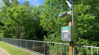
A stream gauge on Rose Lane that'll track water levels in Walnut Creek.
We have multiple stream gauges spread across the city to track flooding. Some also track wet weather impacts on the sanitary sewer system.
Stream flow and rainfall tracking is in partnership with the Unites States Geological Survey (USGS).
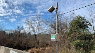
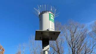
Rain Gauge Locations
A rain gauge on S. State Street.
We have rain gauges at most of our stream gauge locations along with seven rain gauges at Raleigh Fire Stations.
Rain gauges show how much rain has fallen in an area and sends the data into the Flood Early Warning System improve accuracy for predicting flooding.
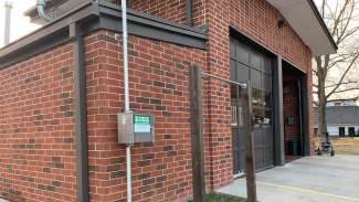
The rain gauge signal box installed on Fire Station 15.
Rain Gauges at Fire Stations
We chose these seven locations because they provide 24/7 emergency operations and are spread out across the city.
| Active Rain Gauge Locations | |
|---|---|
| Fire Station 5 on Oberlin Road | Fire Station 21 on Southall Road |
| Fire Station 15 on Spring Forest Road | Fire Station 23 on Pinecrest Road |
| Fire Station 18 on Morgan’s Way | Fire Station 26 on Barwell Road |
| Fire Station 19 on Spring Forest Road | |