Jump To:
How it Works
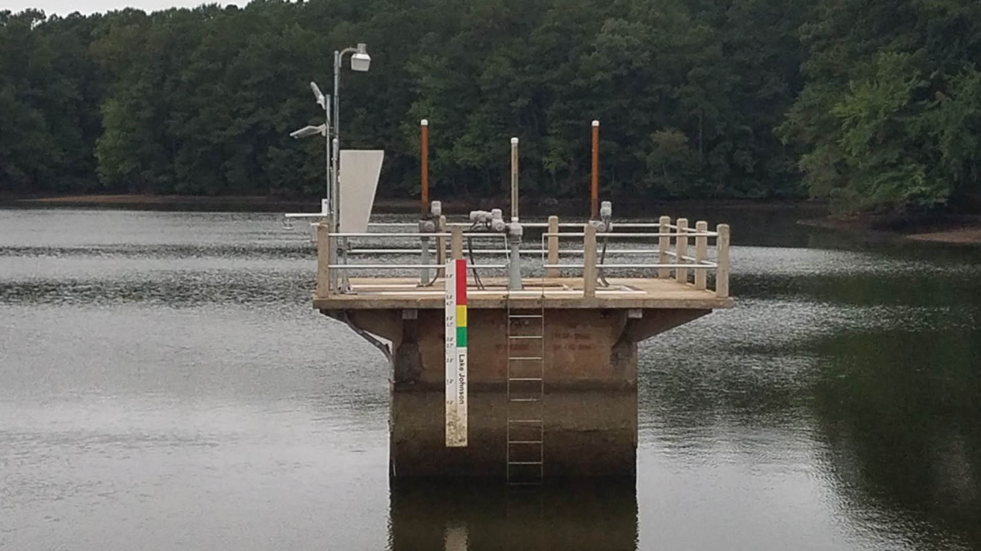
We can automatically lower water levels in the dam at Lake Johnson to respond quickly to heavy rain and prepare for flooding from a major storm. Lowering the lake before a storm provides more room for water to fill in the late, controls the flow of water, and allows less water to flow downstream causing severe flooding.
We monitor a storm and lower water levels 6-8 hours prior to when the storm is forecasted. This process is done remotely. An alarm will sound when the lake water is being lowered and we close the valves before the storm reaches our area so that excess water does not flow downstream.
Checking the Lake
We use a camera to track the lake’s water level and storm flows in real time. We can see when we need to:
- Safely open the valves at the dam and lower water levels to limit impacts from flooding.
- Make sure water isn’t leaving the dam too fast (only two feet per day).
- Fix issues with water flow that could impact residents downstream.
The camera takes a photo every five minutes (Images aren’t recorded/saved). You can see what we see on the US Geological Survey (USGS) River Cam website.
You can also watch a timelapse of Lake Johnson Dam with images taken every hour and view historical lake levels.
Benefits
More efficient.
It used to take up to a day for staff to open the valves and lower water levels at a lake. Now, we can respond and open the valves within minutes.
More prepared.
We see conditions in real time and notify first responders sooner to prepare for flooding.
More focused on the environment.
We control the flow of water to protect the shorelines of the lake.