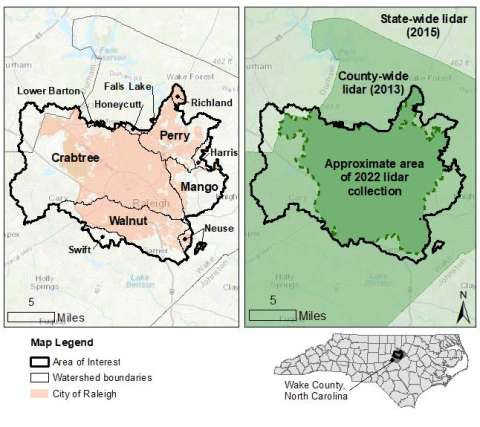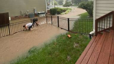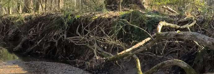
The City of Raleigh partnered with the US Geological Survey (USGS) to complete a Comprehensive Assessment of Streambank Erosion Hotspots in Raleigh, NC project.
This project will predict streambank erosion potential using remotely detected datasets. Results will provide the City with a city-wide dataset of streambank erosion hotspots that can be used to identify areas with severe erosion problems, as well as areas with stable streambanks. This information allows the City to deploy staff for field investigations and prioritize opportunities for stream restoration and stabilization projects. This study informs future watershed strategies and creates a framework for the City's developing Stream and Riparian Program.
Learn about the USGS’s latest findings in their Erosion Hotspots StoryMap.
Project Details
- Type:
-
Stormwater
- Budget:
-
$394,100
- Project Lead:
-
Stormwater Management
- Contractors:
-
Partnered with USGS