Project Overview
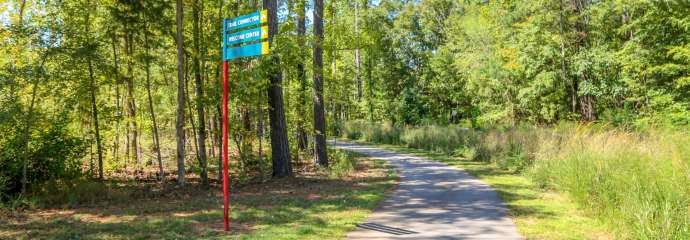
In January of 2024, the City of Raleigh’s Parks, Recreation, and Cultural Resources Department began a year-long process to develop a Capital Area Greenway System Wayfinding Plan. The Wayfinding Plan includes new directional signage that will improve navigation for trail users whether they’re using the system for recreation or transportation. New signage types include both text and map-based information, distance to major destinations and amenities as well as provide context for what is in the immediate vicinity of a sign that may not be visible from that location. The Plan also includes a decision-making guide to help determine where specific signs should be placed and what type of information should be included. The Plan will be implemented in future signage installations. and when funding is available.
Project Details
- Type:
-
Greenways and Trails
- Project Lead:
-
Kris Nikfar, AICP
- Contractors:
-
Toole Design Group