Published 3/30/2026 at 4 p.m.Updated 4/3/2026 at 6 p.m.
Thank you for printing this page from the City of Raleigh's Official Website (www.raleighnc.gov)
https://raleighnc.gov/stormwater/services/find-your-watershed/hare-snipe-watershed
01/27/2026 1:14 pm
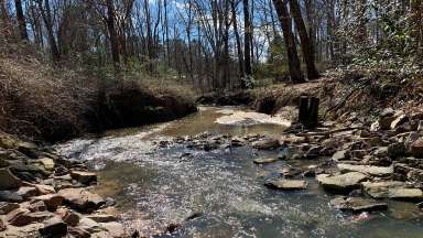
The Hare Snipe Creek Watershed is located in Northwest Raleigh and is one of 36 watersheds in the city. It covers more than seven square miles across Raleigh and Wake County, with over five square miles within the city limits.
Hare Snipe Watershed Facts
Flows from north to south with the head waters or water's source near Springdale Estate.
Joins with Crabtree Creek just south of Glenwood Avenue.
Flows south to eventually reach the Neuse River.
Several unnamed streams or tributaries also flow to this creek.
Watershed Map
The map shows the outline of the Hare Snipe Watershed. Zoom into the map to see the location of the stormwater system and some recent stormwater projects. Raleigh Stormwater maintains the areas in yellow. Click the three lines on the map (upper right corner) to see what the icons mean.
Projects in the Watershed
We completed a study of the Hare Snipe Watershed and identified projects that would reduce flooding, improve water quality, and protect the community. Below are active or completed projects that came from the watershed study.
The Hare Snipe Watershed Study was completed in 2023. From the study, we created a watershed plan that will help us make informed and strategic decisions about stormwater projects planned over the next several decades.
Work During the Study
Checked streams and creeks for erosion
Inspected stormwater pipes and drains
Tracked water flow to find predicted roadway, structural, and yard flooding.
Analyzed water quality to identify common pollutants
We hosted three public meetings and received public observations and feedback in our online survey.