Pigeon House Creek

Pigeon House Branch Watershed

Our Local Watersheds


Jump To:

 
Watershed Study About Pigeon House Branch Stormwater System Watershed Map

Watershed Study

We are doing a study of the Pigeon House Branch Watershed. Learn more about our work on the Pigeon House Branch Watershed Study.

About Pigeon House Branch

The Pigeon House Watershed covers over four square miles in and near downtown Raleigh and is one of 36 watersheds in the city. The watershed is bordered on the south by Hillsborough Street and New Bern Avenue, on the east by State Street and Bennet Street, on the west by Oberlin Road, and on the north by Fairview Road and Whitaker Mill Road.

  • Pigeon House Branch begins near the Village District, follows Capital Boulevard and joins with Crabtree Creek at Crabtree Boulevard and N. Raleigh Boulevard. Flows eventually reach the Neuse River. 
  • Cemetery Branch is the largest tributary to Pigeon House Branch
  • Over the years, the main stem of Pigeon House Branch has undergone extensive channelization, realignment, and confinement in underground concrete box culverts or walled channels to address historical flooding and erosion problems.

Stormwater System

A section of Cemetery Creek that runs under ground. This images shows a stone block culvert near Elm Street, built in the early 1800's. 

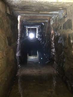
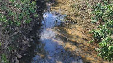
A section of Cemetery Creek runs through a stone block culvert near Elm Street, built in the early 1800's. 

  • Stormwater infrastructure, like culverts, pipes and drains, help safely collect and carry stormwater runoff into the creek when it rains. Water can also flow through the system under roads, driveways, and bridges before it reaches creeks.
  • Pigeon House watershed contains some of the City’s oldest stormwater infrastructure, dating back to the early 1800s.
  • There are over 75 miles of stormwater pipes and streams in this watershed.  Approximately 28 miles are maintained by the City. The remainder are located on state, county, or private property.

Watershed Map

Zoom into the map to see the location of the stormwater system and some recent stormwater projects. Raleigh Stormwater maintains the areas in yellow. Click the three lines on the map (upper right corner) to see what the icons mean.

Contact


Barbara Moranta, PE
Planning and Asset Manager 
barbara.moranta@raleighnc.gov
919-996-3976

Department:
Engineering Services
Service Categories:
Stormwater
Related Services:
Watersheds in Raleigh

Subscribe