Jump To:
About this page
This page highlights and provides documentation of our public engagement efforts during the Six Forks Road Improvement Project.
Despite modifications to the project scope in 2024, it was determined that the Six Forks Improvement Project could not be built with the available funding. The Raleigh City Council approved reducing the project scope and reallocating the remaining funds to other City projects.
Fall 2023 Project Options Engagement
The design of the Six Forks Road Improvement Project started in the spring of 2020, with a budget of $31.3M. However, with the significant increase in real estate and in construction costs from 2020 to 2023 the new budget for this proposed project increased to $119.0M. The large funding gap could not be addressed with the City’s current funding resources.
City staff assessed different options for this project, and on Oct. 17, 2023, options were presented to City Council. These options were also presented to the public. Below are the results from that survey.
Survey Results and what they mean.
The survey type we used is called a ranking question. This format is the best format to use when trying to identify the highest preference, not just the most votes. This type of question measures both the number of votes for each option and the priority level of each option.
Here are the survey results
Breaking the survey down:
- The gray box is how people ranked the option.
- Colored rectangles show the percentage of people who raked that option at all.
- The number on the right is the raw number of people who ranked the option at all.
- The result for the top preferences is shown in shaded area.
Here are the five options we presented to the City Council on October 17, 2023.
| OPTION 1 | OPTION 2 | OPTION 3 | OPTION 4 | OPTION 5 |
| Cancel or restart the project | 6-lane median divided - Rowan to Millbrook | 6-lane median divided - Rowan to North Glen | Separated Bike Path and Sidewalk - Rowan to Lynn | Multi-Use Path - Rowan to Lynn |
| Cost - $3.0M For design efforts already completed | Cost - $66.2M | Cost - $35.6M | Cost - $49.4M | Cost - $44.0M |
Considerations
| Considerations
| Considerations
| Considerations
| Considerations
|
| Estimated Completion - unsure | Estimated Completion - 48 months | Estimated Completion - 32 months | Estimated Completion - 48 months | Estimated Completion - 48 months |
In Person Engagement
- BPAC Planning Committee Meeting - Tues. October 24, 5:15-6:15 p.m.
- District A Town Hall Meeting - Wed. October 25, 6-7:30 p.m.
- Transportation and Transit Committee Meeting - Thurs. October 26, 3 -4:30 p.m.
Watch the Oct. 17, 2023, City Council Six Forks Presentation.
Six Forks Road Improvement Project Update - October 17, 2023 - Raleigh City Council Presentation
Public Engagement Events
| Event | Date |
|---|---|
| Project Pre-Design Public Engagement | October 2020 |
| Mid-Town Alliance Presentation | Spring 2021 |
| District A Town Hall Meeting & Presentation | June 2021 |
| Project Design Virtual Open House / Stakeholder Engagement Meetings | Fall 2021 |
| Mid-Town CAC Presentations | Quarterly Updates |
| Mid-Town Alliance Presentation | August 2022 |
| District A Townhall Meeting & Presentation | August 2022 |
Project Design Public Engagement
We had a Project Design Virtual Open House from Sept 22 through Oct 17 to show the proposed design plans and get public feedback.
During the open house, we had two virtual public meetings. We also collected comments regarding the proposed designs and met with impacted property owners along the corridor to discuss the design plans and get their input.
View Public Comments from Open House
We produced a video explaining some of the updates made to the design after the Pre-Design Public Engagement. We also recorded the two live virtual public meetings we had.
View Open House Videos
Six Forks Road Improvement Project – Virtual Open House
The City of Raleigh is planning to improve Six Forks Road between Rowan Street and Lynn Road. This video shows some of the exciting enhancements the City plans to install along the corridor.
Six Forks Virtual Public Meeting Sept. 29 - Roadway Design and Construction
Six Forks Road Improvement Project Virtual Open House Oct 5 - Roadway Design and Construction
Six Forks Road Improvement Project – Virtual Open House

Six Forks Virtual Public Meeting Sept. 29 - Roadway Design and Construction

Six Forks Road Improvement Project Virtual Open House Oct 5 - Roadway Design and Construction
Project Maps
These are old project maps that have the original schematic design plans that show the proposed design elements along the entire corridor. The project was cut to end at Millbrook Road on Feb. 20, 2024.
The project maps are in a PDF format to allow the viewer to zoom in for a closer look.
Public Engagement During Right of Way Acquisition
Our real estate team and the project manager are reaching out to property owners along the corridor to talk with them about the possible impacts to their property. This is a lengthy phase for most roadway projects, as the team talks one on one with every property owner along the corridor. To learn more about the Right of Way Acquisition phase visit the main project page.
FAQs
Frequently Asked Questions
These FAQs represent questions we gathered during the Fall 2022, Virtual Open House.
Can a traffic signal be added for my street?
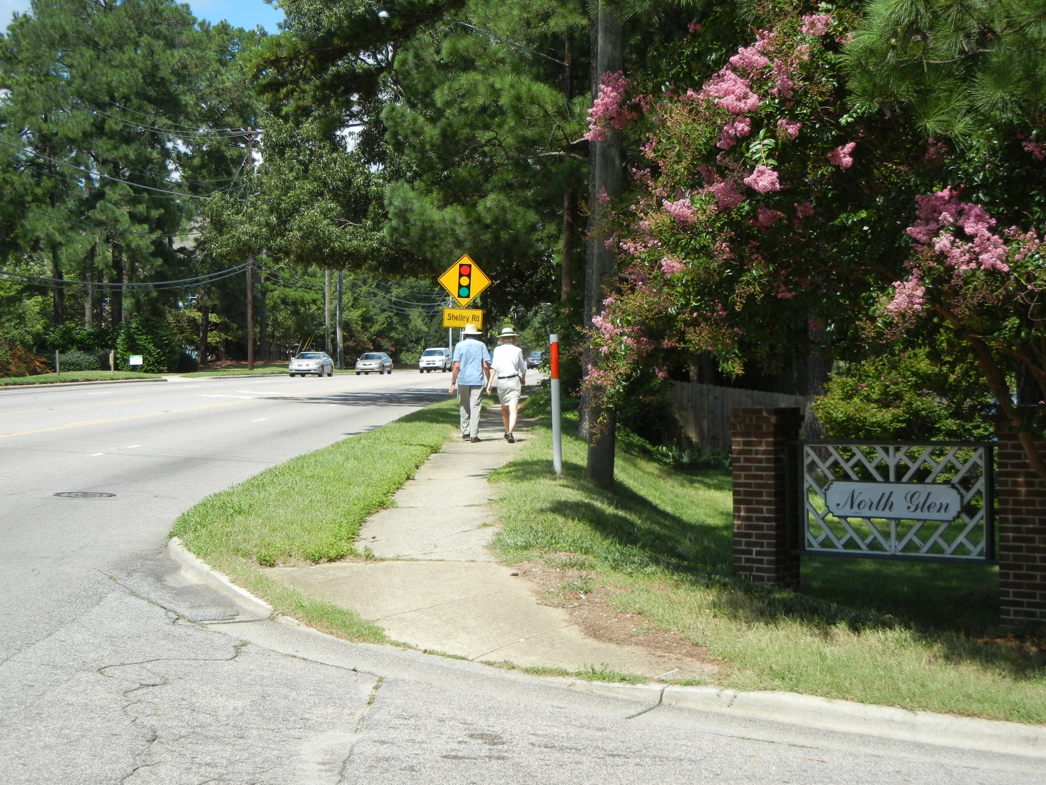
There are currently no plans to add or modify the traffic signals as shown on the public meeting maps. The new signals proposed at North Glen and Loft Lane were added to allow full movement access to streets that serve large neighborhoods while meeting NCDOT signal spacing requirements. All proposed signals will allow protected U-turns to minimize impacts to travel time.
Can a left turn be added at my business?
We understand that restricting left turns where people have historically been able to make left turns can be upsetting and that travel times may increase along the corridor, but several studies within the state and around the country show large reductions in crashes and fatalities after installing a median. All of the proposed traffic signals will allow for protected U-turns and the intersections will be signed as No Right on Red.
Why are you proposing narrow lanes like Falls of Neuse Road?
The lanes on Falls of Neuse Road in some places are currently less than 9 feet in width and similar to the current lane widths on Six Forks around the North Hills area. The lane widths on the proposed section of Six Forks between Rowan Street and Lynn Road will be made a consistent width of 10 feet. These lane widths are allowable under design criteria and studies indicate that there is a reduction in the overall upper speed limit without a corresponding increase in accidents. Changing the speed limit alone is insufficient to improve speed compliance and reduce accident severity. The lane widths not only reduce impacts to adjacent properties, it also reduces the overall time it takes for pedestrians to cross the street and helps achieve multiple safety goals for the project.
How will traffic on my neighborhood street be impacted by the design of Six Forks?
At this time it is difficult to determine driver behavior in how they will attempt to find faster or shorter ways of getting to their destination. The City typically won’t install traffic calming measures on a neighborhood street until there is a demonstrable traffic issue. As traffic adjusts to the new layout of Six Forks and shortcuts through neighborhood streets are identified, the City’s Neighborhood Traffic Management will be able to assist determining if traffic calming measures are warranted.
Will there be a pedestrian bridge at North Hills?
There are currently no plans to add a pedestrian bridge or tunnel in this phase of the Six Forks project and may be evaluated in future phases. However, all intersections within the project limits shown on the public meeting maps will be designed as protected intersections that improves the safety and visibility for pedestrians as well as cyclists.
Why are you adding bike lanes when no one currently bikes on Six Forks?
People currently ride their bikes along the existing narrow sidewalk and mix with pedestrian traffic. Separated bike facilities behind the curb were originally envisioned in the corridor study phase of the project and recent UDO text changes adopted by the City Council make these facilities a requirement on streets like Six Forks. The addition of the separated bike lanes on Six Forks in conjunction with other bike improvements under construction by the City will provide safe bike access to homes and businesses along the corridor.
How will bikes trigger signal changes at the intersections?
Cyclists will need to press the button on the pedestal adjacent to the traffic signal to trigger a light change. Currently, NCDOT doesn’t support bicycle specific signals or detection and the City currently doesn’t maintain an inventory of these items for future maintenance needs.
Will all transit stops have shelters?
All proposed transit stops will have shelters. Stops that allow transfers between different lines will be larger with more accommodations. The City is currently evaluating adding bike-share facilities at transit stops near existing or proposed bikeways.
Why is there a roundabout proposed at Rowan Street and Revere Drive?
The roundabout was identified in the corridor study phase to help alleviate backup of traffic on Six Forks for parents waiting to drop-off their children at Carroll Middle School. The drop-off entrance at the school will be restricted to right-in/right-out and parents will need to utilize the roundabout to access the school.
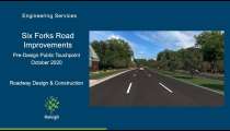
Pre-Design Public Touchpoint
We held a pre-design virtual touchpoint in late October 2020, and finished collecting public comments in mid-November 2020.
What is the Pre-Design?
Pre-design is when we conduct preliminary topographical surveys, traffic analysis, and public and private utility location investigations. We also get feedback from the public on design concepts that we are proposing. This information helps our engineers determine what we can bring to the table for our roadway improvement projects.
The Six Forks Road Improvement Project is a result of a corridor study that also helped to guide the design concepts that we are proposing.
Project information videos
View these videos to learn more about the planning process and scope of the Six Forks Road Project.
Six Forks Road Improvements are Coming to Raleigh - Roadway Design and Construction
Six Forks Road Improvements - Pre-Design - Roadway Design and Construction
Six Forks Road Improvements are Coming to Raleigh - Roadway Design and Construction