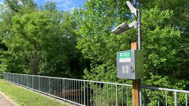
A US Geological Survey stream gauge near Walnut Creek

A stream gauge on S. State Street. 

Stream and Rain Gauges

See how we monitor stream levels and rainfall in Raleigh


Jump To:

 
Stream Gauge Locations Rain Gauge Locations During a Storm Follow Water Levels

Stream Gauge Locations

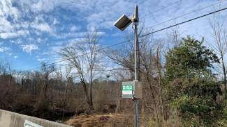
A stream gauge on Rose Lane that'll track water levels in Walnut Creek

A stream gauge on Rose Lane that'll track water levels in Walnut Creek. 

We have multiple stream gauges spread across the city to track flooding. Some also track wet weather impacts on the sanitary sewer system.

Stream flow and rainfall tracking is in partnership with the Unites States Geological Survey (USGS).

See all stream gauge locations on the live flood monitoring map!

Active Stream Gauge Locations
Crabtree Creek
  • Ebenezer Church Road
  • Glenwood Avenue (Highway 70)
  • Anderson Drive
  • Old Wake Forest Road
  • Capital Boulevard (Highway US-1)
Walnut Creek
  • Buck Jones Road
  • Lake Johnson
  • Trailwood Drive
  • South Wilmington Street
  • South State Street
  • Rose Lane
  • Sunnybrook Road
Pigeon House Branch
  • The Village District (East Forest Drive)
  • Fenton Street
Marsh Creek
  • Stony Brook Drive
Rocky Branch
  • Pullen Road

Rain Gauge Locations

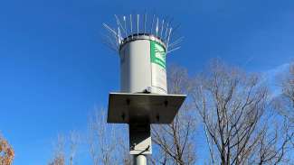
A gauge that'll measure rainfall in a specific area.

A rain gauge on S. State Street. 

We have rain gauges at most of our stream gauge locations along with seven rain gauges at Raleigh Fire Stations.

Rain gauges show how much rain has fallen in an area and sends the data into the Flood Early Warning System improve accuracy for predicting flooding.

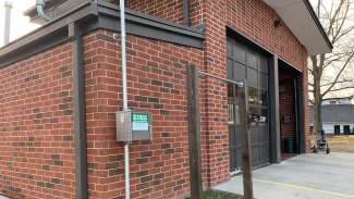
The rain gauge signal box installed on the outside of Fire Station 15.

The rain gauge signal box installed on Fire Station 15. 

Rain Gauges at Fire Stations

We chose these seven locations because they provide 24/7 emergency operations and are spread out across the city.

Active Rain Gauge Locations
Fire Station 5 on Oberlin Road Fire Station 21 on Southall Road
Fire Station 15 on Spring Forest Road Fire Station 23 on Pinecrest Road
Fire Station 18 on Morgan’s Way Fire Station 26 on Barwell Road
Fire Station 19 on Spring Forest Road  

Benefits for Rain Gauges at Fire Stations

  • Easy access when repairing gauges.
  • Better predictions on flooding for first responders.
  • Efficient way to compare radar rainfall estimates with on-the-ground measurements.

During a Storm

Leading up to and during a storm we: 

  • Monitor rainfall and stream flow;
  • Identify flooding impacts; and,
  • Alert first responders early for road closures.

Stream gauges also help indicate whether or not a lake needs to be lowered before a storm to protect people and their properties.

Follow Water Levels

There are a few ways you can see the water and rainfall levels from the gauges: 

USGS installed a camera and stream gauge to monitor Walnut Creek at South State Street.

Contact


Kelly Daniel
Flood Early Warning System Manager
jonathan.daniel@raleighnc.gov
919-996-4020

Department:
Engineering Services
Service Categories:
Stormwater
Related Services:
Track Storms with Us

Subscribe