Jump To:
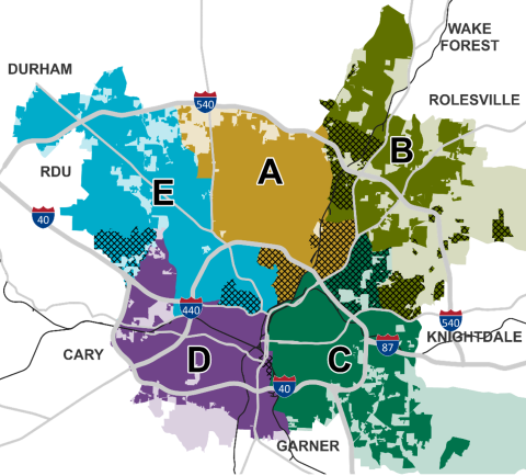
Previous City Council District Map
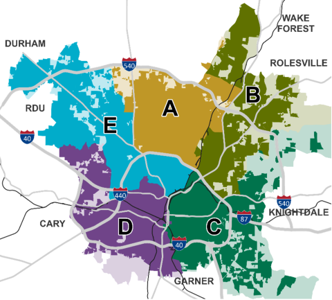
The map above displays the Council Districts as they existed, which are composed of Voting Precincts defined in the Adopting Resolution 2011-380 effective June 7, 2011, which established our Council Districts following the 2010 Census. Lighter shaded areas are parts of a Voting Precinct that would be in the matching Council District if they were annexed into the City.
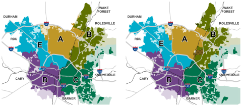
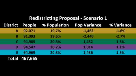
Redistricting Scenario 1
Scenario 1 offers the least change possible to bring the districts into balance. In this scenario, one Voting Precinct moves from District A to District B to correct the population imbalance and one Voting Precinct moves from District B to District A to improve the compactness of the two districts.
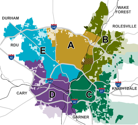
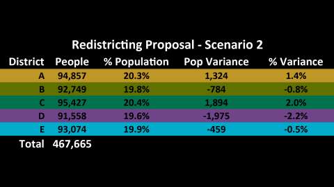
Redistricting Scenario 2
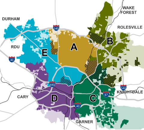
Scenario 2 starts with Scenario 1 and offers additional changes. More future growth area in the northeast is assigned from District C to District B. District B also takes in more area north of 540 while losing the Brentwood neighborhood to District A. District C gains neighborhoods between Capital Boulevard and New Hope Road such as Starmount. Neighborhoods north of Wade Avenue are consolidated into District E rather than being split. These and other changes balance population but leave more room for growth in District B. This alternative has the lowest deviation from ideal population, with no district more than 2.2 percent away from ideal.

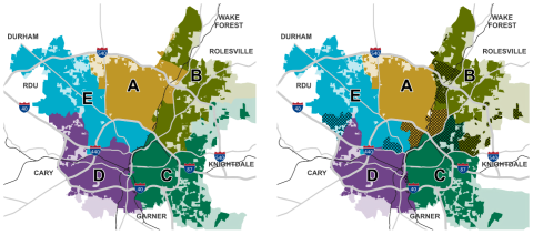
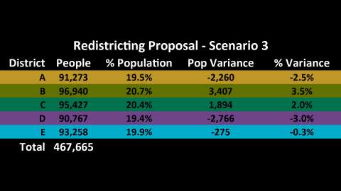
Redistricting Scenario 3
Scenario 3 is similar to Scenario 2, but makes further changes to District E. Under this alternative, District E gains all the neighborhoods around Umstead Park, but in turn loses some inside-the-beltline neighborhoods, such as Drewry Hills to District A. Currently, both Districts A and B are entirely outside the 440 loop; under this alternative, this would remain true only for District B.