Jump To:
Designation Documents
A post-WWII subdivision built for African Americans.
Period of Significance: 1957 – 1964
Properties with a contributing status in the district may be eligible for the federal and state historic tax credit programs. Visit the Historic Property Tax Credit webpage for more information.
History
Rochester Heights was developed on land owned by Anna Roberta Lightner and Lawrence Eugene Lightner, brother of Clarence E. Lightner, Raleigh’s first black mayor. In 1954, Lightner sold the property to M.C. Garner of the Phillips Building Corporation. Today, the Lightner family cemetery is still located at the entrance to Rochester Heights, although it is not part of the historic district.
Platted in 1956 and 1958, Rochester Heights was developed within a framework of covenants that ensured uniform lot sizes, setbacks, layout, and building and outbuilding sizes and types. A number of Rochester Heights’ later homes were built from plans published by Key Homes, a now-defunct house plan company responsible for many Raleigh residences.
Rochester Heights’ streets were named for famous African Americans of the time, including Cab Calloway, Ray Charles, Pearl Bailey, Larry Doby, and Clayton "Peg Leg" Bates. Many prominent black families lived in the development, including Samuel Mitchell, an attorney who helped lead the fight to integrate Wake County schools, and North Carolina Senator Vernon Malone. Still, the development was economically diverse, home to educators, physicians, government workers, clergy, and laborers.
A good example of a post-WWII suburban subdivision and one of four Raleigh developments built for African Americans, Rochester Heights is notable for its use of modern housing styles and continues to exhibit a high degree of architectural integrity.
Historic District Map
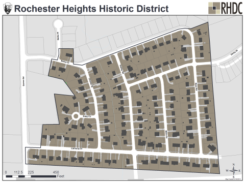
This National Register district map is for illustrative purposes only and is not the official zoning map, which is maintained in iMaps.
Physical Description
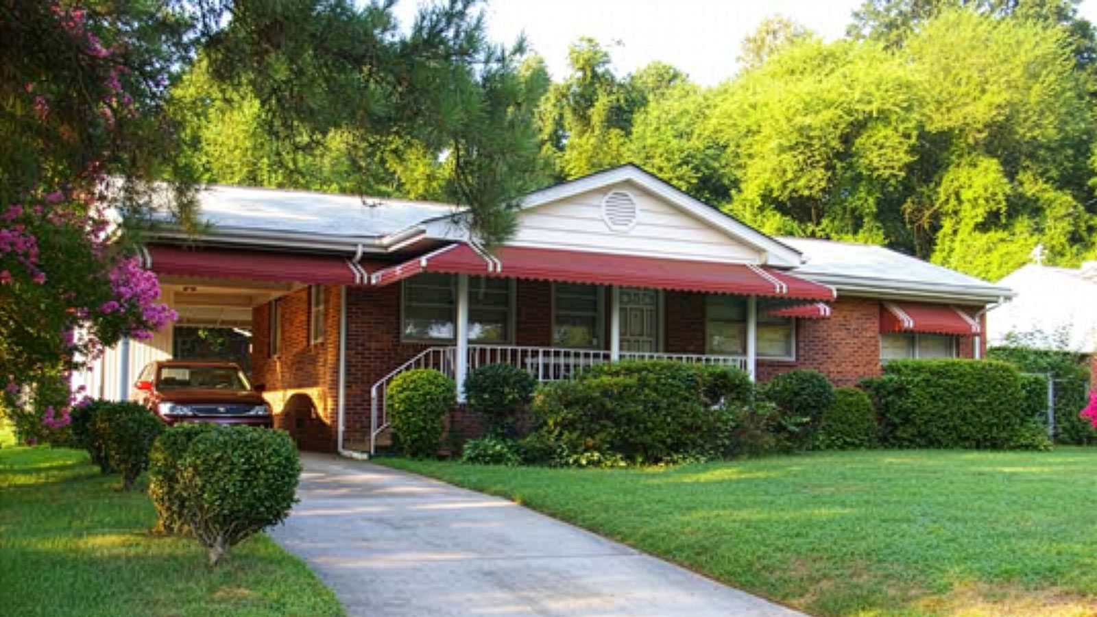
Rochester Heights is one of a small number of developments completed for African Americans during segregation. It is located 1-½ miles southeast of downtown Raleigh. The 39-acre development, built between 1957 and 1964, features a largely intact collection of post-World War II homes. Lots range in size from ¼ to ⅓ of an acre, with most houses parallel to the street. Many of the homes feature extensively landscaped yards.
The district’s dominant architectural style is Ranch: one-story homes with low-slung, horizontal configurations, side-gable roofs, large picture windows, patios or porches, and carports or garage bays. There are two Split-Levels in the Rochester Heights, each incorporating typical characteristics: a one-story wing intersecting a two-story wing, a multi-light picture window, an entry stoop, a first-story garage, a wide central brick chimney, and a recessed entry. Architectural details such as tripartite windows, brick planters, inverted triangular porch posts, brick or stone half-walls on the façade, and plywood board-and-batten siding continue to reflect the district’s development period.