Jump To:
Designation Documents
Site of a former early training school for African Americans in the Method community.
Period of Significance: 1923 – 1966
Properties with a contributing status in the district may be eligible for the federal and state historic tax credit programs. Visit the Historic Property Tax Credit webpage for more information.
History
The Berry O’Kelly Historic District, with its religious, commemorative, funerary, recreational, and educational resources, is the historic institutional core of the Method Community. Method was a settlement of free African Americans established shortly after the Civil War. The area is important in the areas of African American ethnic heritage and education, and its association with Berry O’Kelly, who helped to establish the school.
O'Kelly was born in slavery, but through hard work and talent became a prominent businessman whose philanthropy was connected to both the church and school. He purchased the Woods general store in 1873 and served as Method’s first postmaster. The property served as the site of a school beginning in 1871. A series of increasingly larger main school buildings were constructed to serve the growing student body.
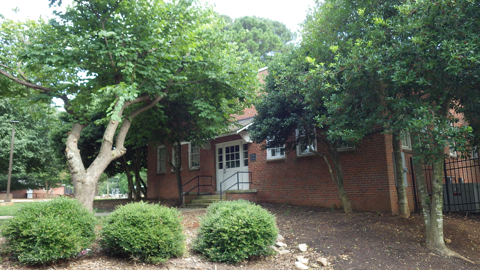
Over time, the Berry O’Kelly School consolidated other black schools in the county and became the only public high school serving Black students in Raleigh until 1924. A new brick school building in 1917 was named in honor of O’Kelly. A large 2-story brick school building was built in 1927 with Rosenwald Funds. The campus eventually boasted 7 buildings, including the still-standing 1928 Agricultural Building. The Berry O’Kelly School closed in 1966 when Raleigh city schools integrated, and the main school building was demolished.
Berry O'Kelly is buried on site at the adjacent St. James African Methodist Church. His 1931 grave and marker are the only burial on the church grounds. The 1923 church building is the earliest remaining structure in the district and is a good example of Gothic Revival architecture.
Historic District Map
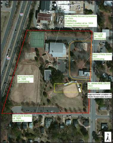
This National Register district map is for illustrative purposes only and is not the official zoning map, which is maintained in iMaps.
Physical Description
The Berry O'Kelly Historic District is an 8.4-acre district in the Method community of Raleigh, approximately 3 ¼ miles northwest of the downtown core. Annexed into the city in 1960, Method was a community of freed African Americans established in the 1870s. Though compromised by highway construction and multifamily residences, an area of modest, predominantly frame, single-story, single-family residences remains. The community is less than a quarter of a mile south of Meredith College and abuts the western end of the Central Campus of North Carolina State University to its south.
The district is bounded by Method Road to the east, Woods Place to the south, Interstate 440 to the west, and lots containing a warehouse and manufacturing to the north. The district is comprised of three parcels of varying sizes. One is owned by St. James African Methodist Episcopal church. The other two parcels, owned by the City of Raleigh, now constitute Method Park and Community Center. The district contains a church property which contains a single grave, and a community center and park containing the last resources associated with a historic school campus.