
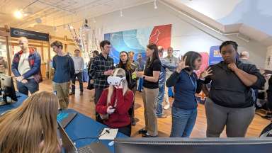
Visitors discovered how maps, data and technology help communities solve problems
The City of Raleigh's Information Technology Department welcomed community members, students, and GIS professionals to the City of Raleigh Museum for GIS Day 2026, a celebration of technology, innovation, and collaboration.
The free event brought together City departments, state and local government agencies, and community partners to demonstrate how Geographic Information Systems (GIS) help solve everyday challenges and improve services for residents.
GIS is technology that connects information to locations on a map, helping people better understand their communities, identify patterns, and make informed decisions. From planning transportation improvements and managing stormwater to protecting natural resources and supporting public services, GIS plays an important role in how government serves the community.
Throughout the morning, attendees had opportunities to explore interactive displays, see technology demonstrations, and speak directly with professionals who use GIS in their work. The event highlighted how mapping technology helps organizations work more efficiently, plan for the future, and address community needs.
Congratulations to the 2026 GIS Day Map Contest Winners
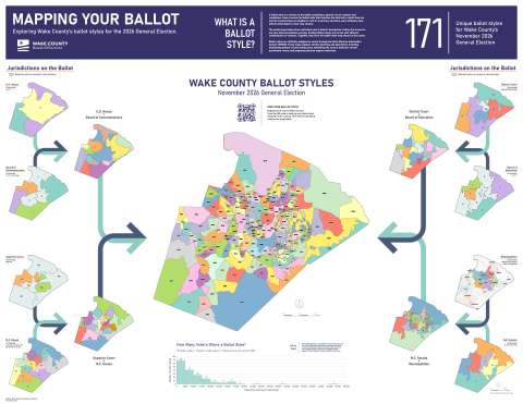
Professional category winner: "Mapping Your Ballot" by Dustin Moss, Wake County Board of Elections
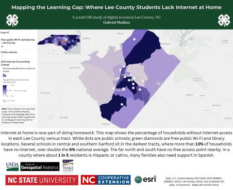
Student category winner: "Mapping the Learning Gap: Where Lee County Students Lack Internet at Home" by Gabriel Medina, 4H
Thank You to Our Participating Organizations
Thank you to teams who tabled at GIS Day event:
4H
Center for Geographic Information & Analysis (State of NC)
City of Raleigh Communications Department
City of Raleigh Information Technology- GIS
City of Raleigh Parks and Recreation
City of Raleigh Planning & Development
City of Raleigh Solid Waste Services
City of Raleigh Stormwater
City of Raleigh Transportation Department
City of Raleigh Transit
NCDOT GIS Unit - Information Technology
NC Department of Environmental Quality
NC Department of Health and Human Services
Raleigh Water
Town of Cary
Town of Holly Springs IT - GIS Division
Wake County Board of Elections
Wake County Planning and Development Services
Wake County Property Mapping
Wake County Project and Portfolio Management
Wake County Public School System