Jump To:
Share your input on bikeways implementation!
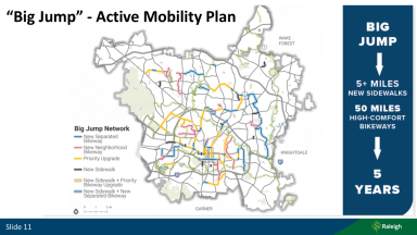
We’re working towards our goals for a safe and connected network for people walking and bicycling that can be implemented quickly. These projects are part of the City’s Big Jump Network and cover five neighborhoods. We want to hear from you. Take The Big Jump Bikeways Project Surveys!
Helpful Links
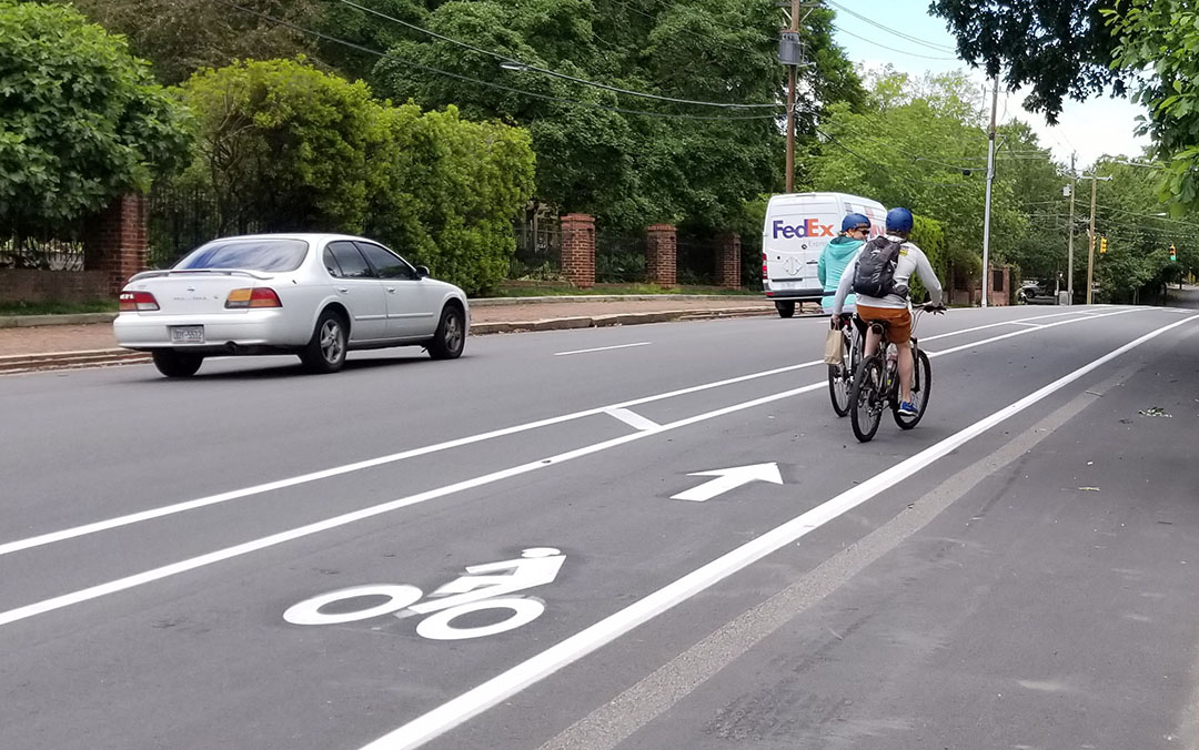
Where Can People Walk and Ride a Bicycle Today?
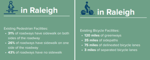
Existing Bicycle Infrastructure
Existing Sidewalk Infrastructure