Jump To:
Speed Limits and Why They Are Important
Setting speed limits is a great tool that we as a city have to help improve the quality of life in Raleigh’s neighborhoods, while also increasing safety in our neighborhoods. There is a direct link between driver speeds and safety, especially for people outside of a vehicle. Pedestrians and cyclists are our most vulnerable users of public streets, and the City of Raleigh is committed to promoting safe streets to ensure that our neighborhoods are happy and healthy.
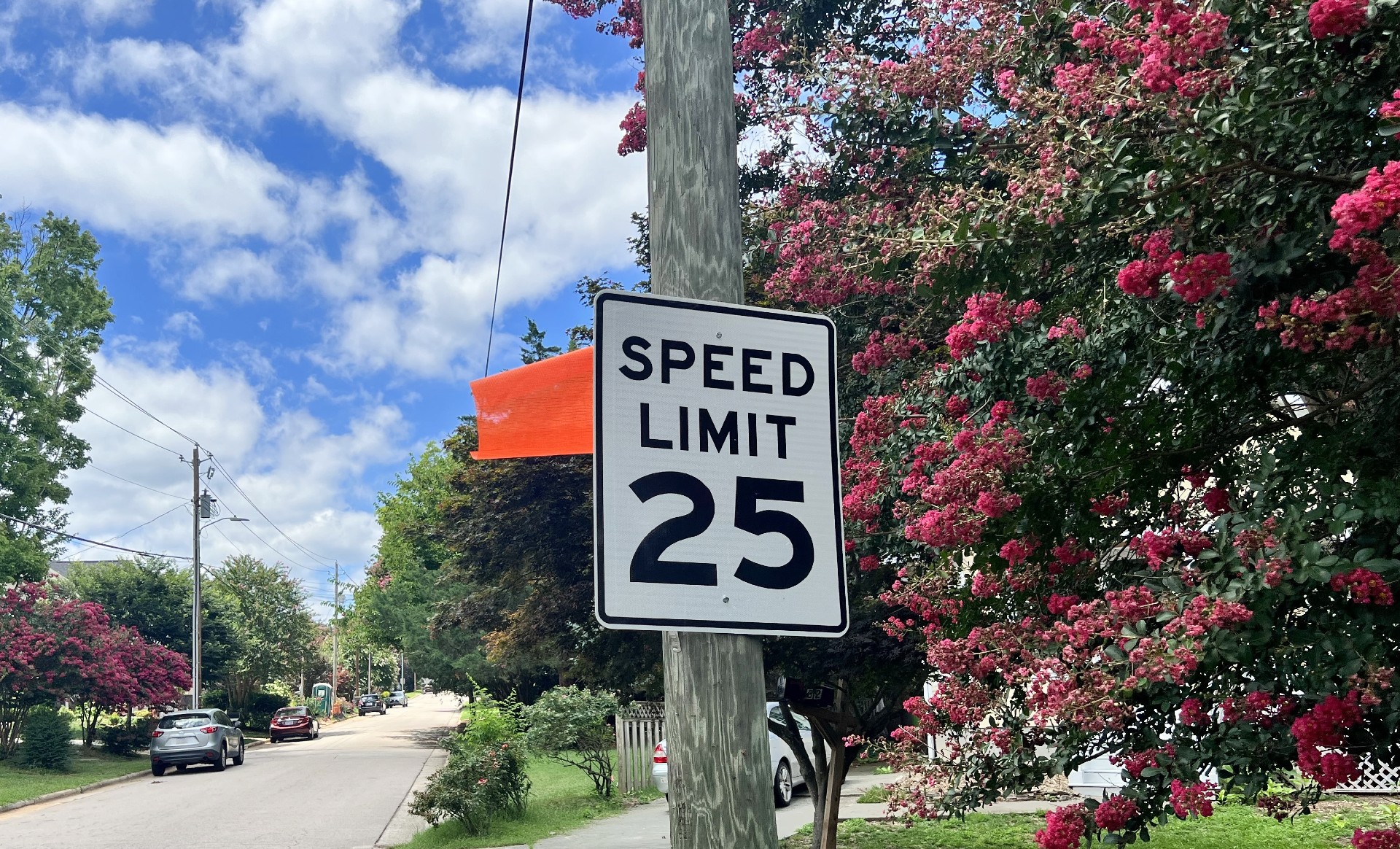
Lowering the speed limit from the current statutory unposted 35 mph is one of the most impactful things that any neighborhood can do to increase safety and quality of life on their neighborhood street.
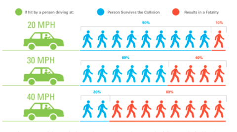
Studies find a direct link between driver speed and severity of the crash when a crash between a pedestrian or cyclist with a vehicle occurs. By lowering speed limits on all of Raleigh’s neighborhood streets, we minimize risk and come closer to our goal of increasing safety in all Raleigh neighborhoods.
To view the context of the graph below, visit the Institute of Transportation Engineers (ITE) for the full report.
Speed Limit Reduction Tracking
Between 2015 and 2025, we have lowered the speed limit on 862 streets which measures out to over 287 miles. Moving forward, we want to continue to increase the number of streets and the miles of streets reduced until all of Raleigh’s neighborhood streets have been successfully reduced.
Yearly Tracking:
2015: 14 streets measuring approximately 4.75 miles
2016: 29 streets measuring approximately 10 miles
2017: 21 streets measuring approximately 7 miles
2018: 35 streets measuring approximately 12.75 miles
2019: 7 streets measuring 2.5 miles
2020: 34 streets measuring approximately 13 miles
2021: 128 streets measuring approximately 54.6 miles
2022: 213 streets measuring approximately 88.28 miles
2023: 186 streets measuring approximately 44.4 miles
2024: 138 streets measuring approximately 34.81 miles.
2025: 57 streets measuring approximately 15.89 miles.
2026: 28 streets measuring approximately 7.37 miles.
Speed Limit Reduction Processing
All streets currently going through the Speed Limit Reduction process are listed below. Ballot periods are open for two weeks, so please ensure to cast you ballot prior to the date listed below your street’s name.
To cast a ballot, you have three options:
- Use the PublicInput link below your street’s name.
- Email your response to NTMP@raleighnc.gov. Be sure to include the name of your street, your unique authorization code, and your "Yes" or "No" vote.
- Call 919-996-4066 to speak with the NTMP staff directly.
If you are interested in requesting a Speed Limit Reduction for your street, please complete the Neighborhood Traffic Management Program Application.
Completed Speed Limit Reductions
All new speed limits will go into effect seven days from Council approval:
Postell Street: Freeman Street to Coleman Street
Currently scheduled to be presented to City Council for approval at the September 01, 2026 Council meeting.
Arckelton Drive: Edwards Mill Road to the end/cul-de-sac
Currently scheduled to be presented to City Council for approval at the September 01, 2026 Council meeting.
Glenmorgan Lane: Windmere Chase Drive to Stowecroft Lane
Currently scheduled to be presented to City Council for approval at the September 01, 2026 Council meeting.
Munford Road: Glenwood Avenue to dead end
Currently scheduled to be presented to City Council for approval at the September 01, 2026 Council meeting.
Loyal Lane: Hiking Trail to Walking Stick Trail
Currently scheduled to be presented to City Council for approval at the September 01, 2026 Council meeting.
Kennedy Street: S King Charles Road to Poole Road
Currently scheduled to be presented to City Council for approval at the September 15, 2026 Council meeting.
Ricochet Drive: dead end to dead end
Currently scheduled to be presented to City Council for approval at the September 15, 2026 Council meeting.
Lombar Street: dead end to dead end
Currently scheduled to be presented to City Council for approval at the September 15, 2026 Council meeting.
Fox Road: Spring Forest Road to Kyle Drive
Currently scheduled to be presented to City Council for approval at the September 15, 2026 Council meeting.
Edgewater Neighborhood Streets: Lazy River Drive, Water Spray Drive, Dry Bed Lane, Roaring Rapids Road, Flowing Drive, River Basin Lane, Stoney Bottom Drive, River Bed Drive, Ripple Road and Overflow Circle
Currently scheduled to be presented to City Council for approval at the October 06, 2026 Council meeting.
Approved Speed Limit Reductions
Lakes Rock Drive: The Lakes Drive to Chain Lakes Court
Council approved the speed limit reduction at the June 16, 2026 meeting. Speed limit signs will be put in place and enforceable within 7 days of this approval.
Spice Ridge Lane: Bashford Road to end/cul-de-sac
Council approved the speed limit reduction at the June 16, 2026 meeting. Speed limit signs will be put in place and enforceable within 7 days of this approval.
Shelden Drive: Rush Street to Marion Road
Council approved the speed limit reduction at the June 16, 2026 meeting. Speed limit signs will be put in place and enforceable within 7 days of this approval.