Jump To:
Designation Documents
A dead-end street of converted single-family houses demonstrates the close association of residential development with the establishment of a nearby college and city park.
Period of Significance: 1893 – 1923
Today, all 13 buildings that made up this district have been demolished and replaced with a new multifamily development and a series of surface parking lots. However, the designation and listing on the National Register of Historic Places has not been reassessed or repealed by the state and National Park Service (NPS). The information provided below are descriptions of the district as it stood when first designated in 2006.
History
This dense collection of intact and well-appointed late-19th- and early-20th-century dwellings is significant in the area of community planning and development. The district exemplifies the close association between residential development and the establishment of a nearby college and city park. Housing construction at Maiden Lane marked the start of a long residential building trend in West Raleigh, fed for half a century by demand resulting from two 1887 land grants by philanthropist R. Stanhope Pullen. These gifts enabled the establishment of the North Carolina College of Agriculture and Mechanic Arts (later called North Carolina State College and eventually North Carolina State University) and Pullen Park.
The Maiden Lane plat, dated 1892, was the first platted area in what became the substantial West Raleigh neighborhood by the middle of the 20th century. Several professors built or occupied dwellings here, and the large park, also under development in the late-19th and early-20th centuries, offered an unparalleled recreational amenity to the new neighborhood.
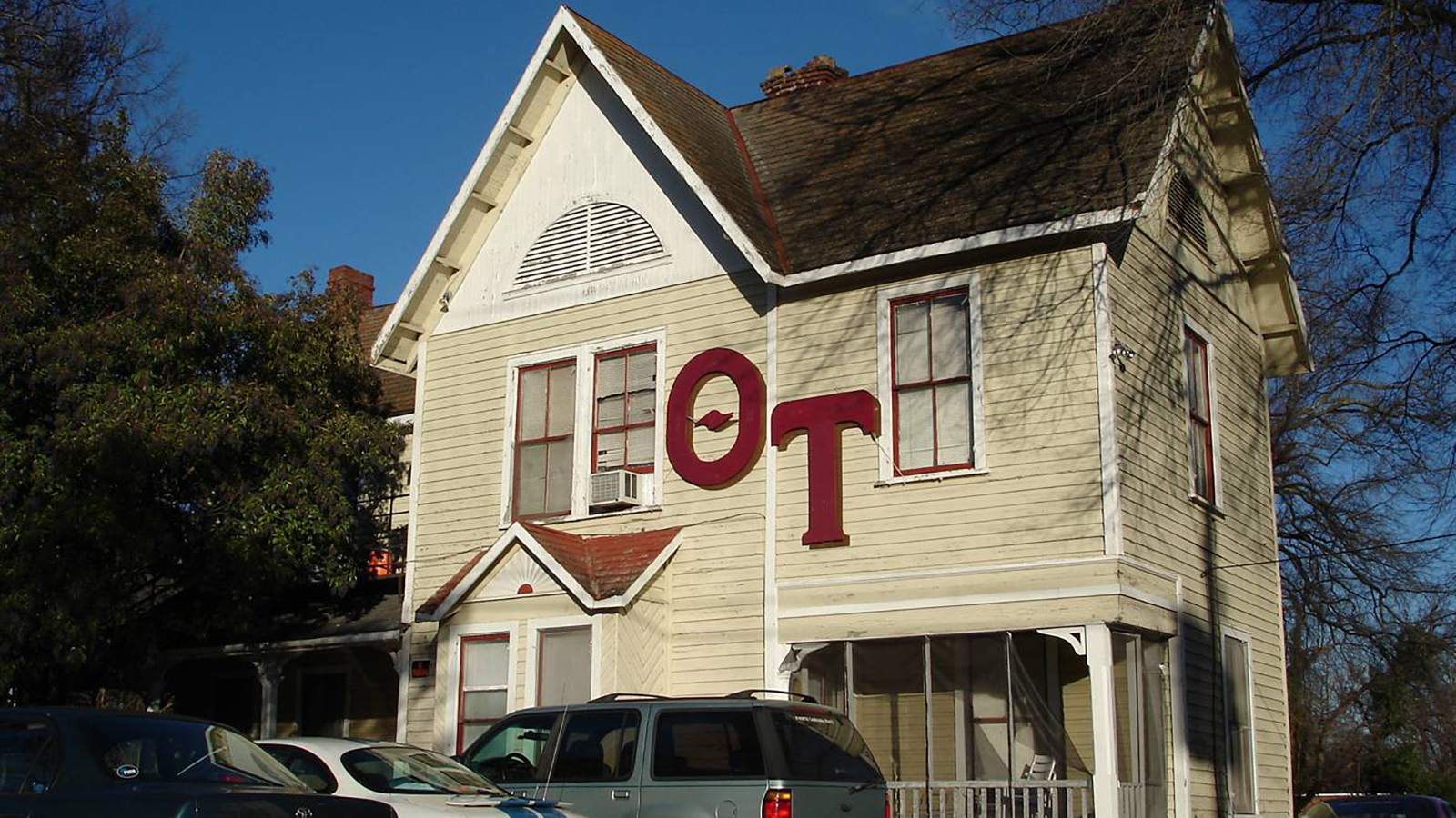
Additionally, the district reflects the streetcar-suburb settlement pattern that occurred in Raleigh during the first years of the 1900s. The streetcar line that extended west along Hillsborough Street encouraged families to live on Maiden Lane in what was then a rural area outside Raleigh. The collection of houses clearly represents the transition in architectural taste from the exuberant Queen Anne style, seen in the twin cottages at 9 and 11 Maiden Lane, to the transitional Queen Anne-Colonial Revival style of the duplexes across Maiden Lane, which featured more restrained architectural elements applied to irregularly massed houses.
The Maiden Lane Historic District’s period of significance begins ca. 1893, when the first house was built, and ends with the construction of the last house in 1923. The street continued to function as a neighborhood of owner-occupied and rented houses where residents had a strong association with the college across the street into the 1950s.
Historic District Map
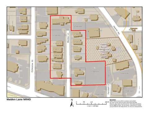
This National Register district map is provided for illustrative purposes only and does not represent the official zoning map, which is maintained in iMaps.
Physical Description
The Maiden Lane Historic District lies west of downtown Raleigh, one block east of the West Raleigh National Register Historic District and just north of North Carolina State University’s iconic bell tower. The Maiden Lane Historic District occupies only one block of its eponymous street. Maiden Lane is a residential, dead-end street that extends north from Hillsborough Street, the major east-west corridor that terminates on its east end at the North Carolina State Capitol. Maiden Lane runs parallel to Enterprise Street to its west and Ferndell Lane to its east.
The district and its surrounding area are densely developed due in large part to the proximity of the university, which was established south of Hillsborough Street in the late-19th century. The parcels located at the intersection of Maiden Lane and Hillsborough Street were historically residential in use and fronted on Hillsborough Street. They now contain modern commercial buildings and are not part of the district.
The district contains domestic resources, several of which have been converted from single-family residences to multiple-occupant dwellings. Large hardwood trees shade many of Maiden Lane’s green lawns, and low shrubs grow along the foundations of the buildings. Concrete sidewalks extend along both sides of the street.
Most dwellings in the district display Queen Anne and/or Colonial Revival influences and are 2-story with asymmetrical massing and weatherboard exteriors. Four houses, all on the west side of Maiden Lane, are single-story houses. The houses in the district have single-story porches. Three duplexes standing side-by-side on the east side of Maiden Lane have wraparound porches, while the other dwellings exhibit full-width or partial-facade porches or porticos. Synthetic siding covers five dwellings in the district; weatherboard and wood shingles sheathe the remainder.